 Rare Maps
  Rare Atlases
  Rare Books
  Rare Prints
  Globes and Planetaria
 Sign up to hear about our latest acquisitions, exhibitions and events


Find Us
New York
PO Box 329, Larchmont, NY, USA
Opening hours, London Gallery
Monday to Friday: 10:00 – 18:00
Saturday: by appointment
Closed: all bank holidays and 1-31 August
Opening hours, New York
By appointment only
Opening hours

Rare Maps
We specialise in rare and historic maps, dating from the 15th to the 19th centuries. Buy rare, vintage, and antique maps, town plans, and sea charts depicting the UK, America, Asia, Africa, and all parts of the world.
(593 results)

Stanford’s large-scale map of New Zealand
STANFORD, Edward
£2,500

Sydney’s CBD
WILLIS, James A.C.
£8,000

Daw’s detailed plan of mid-Victorian St Pancras
DAW, Edmund
£4,500

Sydney Harbour during the Gold Rush
DENHAM, Henry Mangles, Captain
£7,000
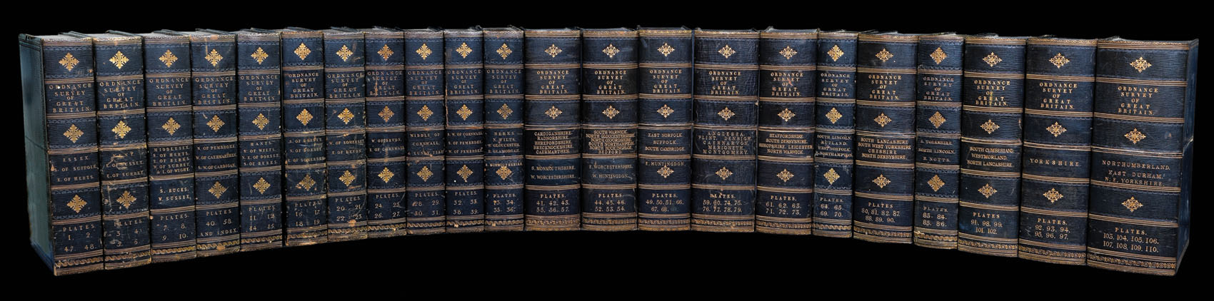
Complete set of the Ordnance Survey of England and Wales in a fine presentation box
MUDGE, Lieutenant Colonel (later Major General) William; COLBY, Major Thomas; BAKER, Benjamin and others
£12,000

The haven of the Romantic poets
LE POER TRENCH, W.; and R.E. CAMERON
£1,000

London Geology
STANFORD, Edward
£650

The Hereford Mappa Mundi
HAVERGAL, Rev. F.T.
£20,000

Victoria during the Gold Rush
WINDSOR, George Andrew; and William SLIGHT
£5,000

Brooklyn as the third largest city in the United States
DRIPPS, Matthew
£1,200

America Hams it Up
BAKER, W[illiam] E[merson].
£12,000

Clean up your act
[LOCAL GOVERNMENT BOARD]
£350
Sign up to hear about our latest acquisitions, exhibitions and events
Find Us
New York
PO Box 329, Larchmont, NY, USA
Opening hours, London Gallery
Monday to Friday: 10:00 – 18:00
Saturday: by appointment
Closed: all bank holidays and 1-31 August
Opening hours, New York
By appointment only