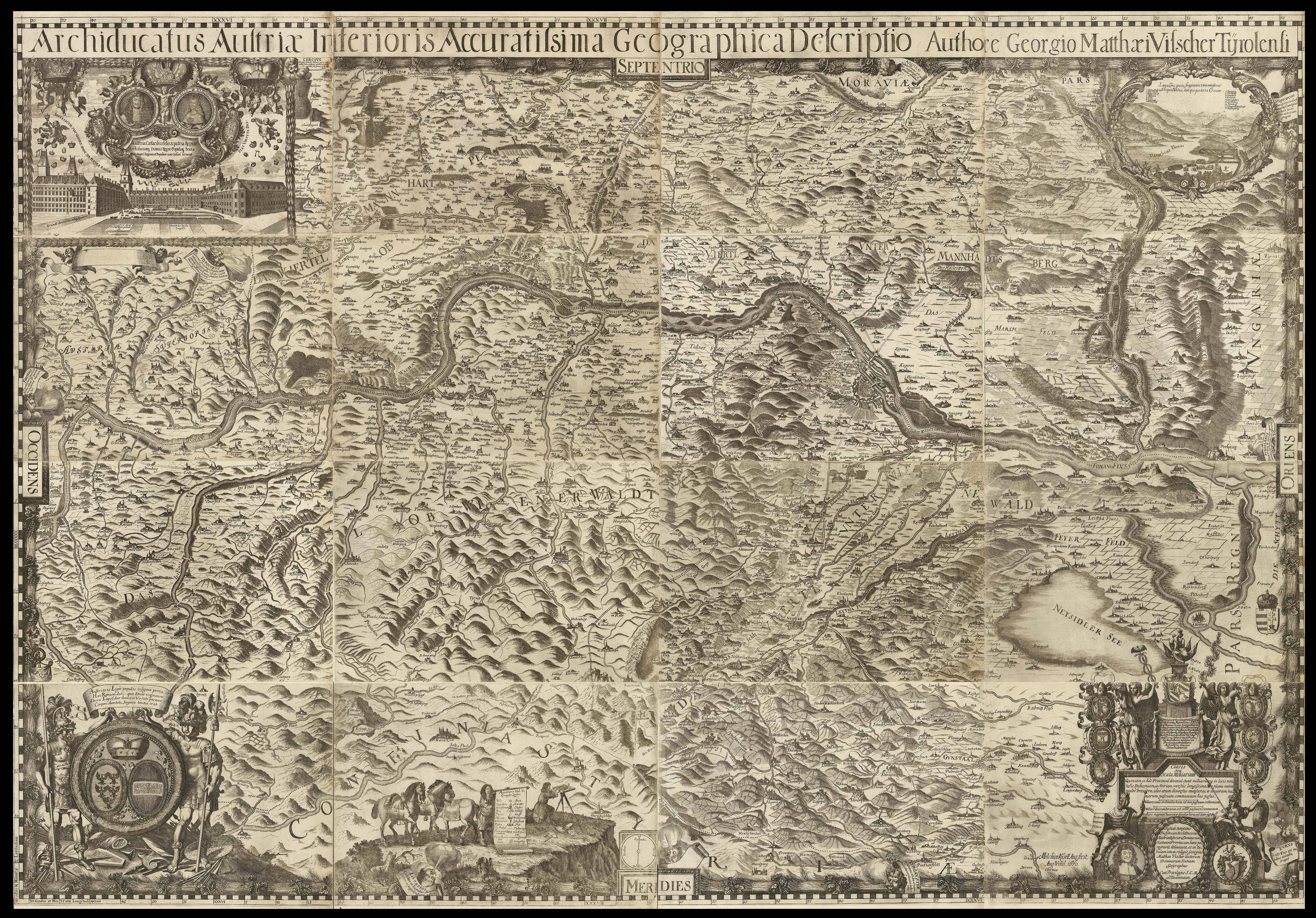

Archiducatus Austriae Superioris… [and] Archiducatus Austriae Inferioris...
- Author: VISCHER, Georg Matthäus
- Publication place: Vienna
- Publication date: 1669 [and] 1670.
- Physical description: A pair of engraved wall maps on 12 and 16 sheets respectively, the map on 12 sheets extending north to south from Passau to the Monastery at Admont, and west to east from Mondsee to Seitenstetten, vignette views of mining, lakes, water mills, and castles, key noting cities, castles, market towns, and churches; the map on 16 sheets extending north to south from Moravia to Stiria, and west to east from the town of Steyr to Prespurg (Bratislava), vignette views of the Danube from Vienna looking west, and the royal residence in Vienna, upper right and left respectively, and fine cartouches lower left and right, some minor loss to corners of a few sheets, each housed within modern quarter red morocco solander boxes.
- Dimensions: 1250 by 1180mm (49.25 by 46.5 inches) and 1220 by 1750mm (48 by 69 inches).
- Inventory reference: 1324
To scale:

Notes
These two wall maps would set the standard for the mapping of Austria until the middle of the next century.
The map of Upper Austria is beautifully engraved by Melchior Kussel. To the corners and sides of the map are topographical vignettes, together with depictions of mines and water mills. Below the plan is a scale bar flanked by two putti, together with surveying tools and globes.
The map of Lower Austria is dedicated to Leopold I (1640-1705), whose cameo, along with that of his royal consort, are depicted above an image of the Imperial Palace in Vienna. The palace would be destroyed during the Turkish siege of 1683. To the upper right corner is a view of the Danube from Vienna looking west, with a key naming the towns and castles. Below the map are two fine cartouches together with a depiction of Vischer surveying using a plane table, with a chain, compass, and notebooks by his feet. Behind him stand three horses, and an assistant who holds up the key to the map.
Georg Matthäus Vischer (1628-1696) was an Austrian cartographer and clergyman. It is unclear how Vischer came to acquire his cartographic training, but by the time he became a parish priest at Leonstein during the 1660s, he was known well enough to be asked to complete a survey of Upper Austria. He was granted leave by his bishop and began in 1667. The following year he submitted the first draft of the map, which was approved, and then engraved by Kussel. The following year the map was published and Vischer began the mapping of Lower Austria, which, in turn, would be published in 1670. He would go on to publish a map of Styria, and topographical books of Lower and Upper Austria. Although his works were well received, he failed to gain all the promised remuneration from the noblemen and gentry of Austria – not an uncommon problem – and was left with a considerable amount of debt. So much so, in fact, that he would die penniless in 1696, having been forced to sell all his books and instruments.
Both maps are mentioned in glowing terms by Johann Georg Keyssler in his work ‘Travels Through Germany’ (1756):
“George Matthew Vischer, a Tirolese, and a minister of Leonstain [sic] in Upper Austria, assisted by one Russel [sic], an engraver, published in the year 1669 a very beautiful map of Upper Austria in twelve sheets. In 1670 they also published with the same accuracy and beauty a map of Lower Austria in sixteen sheets. But in their map of the Dutchy of Stiria, in twelve sheets, they have not succeeded so well.”
They are also referenced, nearly 250 years later, by Lieutenant Colonel Lawrence Martin who worked on the new borders of Austria and Germany marked out in the Treaty of Versailles. He would later, from 1924-46, be head of the map department at the Library of Congress. He wrote:
“Do you suppose the seventeenth century geographer dreamed that his map would be used by an itinerant twentieth century geographer from the wilderness of North America, doing geographical fieldwork in His Sacred Majesty’s Archduchy of Austria, traveling in the uniform of the army of the United States of America, and reporting to a great Peace Conference in Paris about where the boundaries of the proud and venerable Austria might be? I hope maps of mine will live as long!”
He goes on to say, “But this shows what maps can be used for. Maps, multi-shaped, parti-colored, dust gathering objects, the bane of every librarian’s existence, which he has to keep – they do have serious use”: a sentiment that we would like to endorse.
Bibliography
- BL Maps * 28280.(1.)
- FR BNF 40741764
- Munich University 0001/2 Mapp. 88
- UB Augsburg 02/IV.3.2.16
- FR BNF40741749. Johann Georg Keyssler, Travels through Germany, (Bohemia, 1756)
- William Warner Bishop and Andrew Keogh, Essays offered to Herbert Putnam by his colleagues and friends on his thirtieth anniversary as Librarian of Congress, (New Haven: Yale University Press, 1929).
 Rare Maps
  Rare Atlases
  Rare Books
  Rare Prints
  Globes and Planetaria


