- Home
-
Browse
-
Discover
-
About
Find Us
New York
PO Box 329, Larchmont, NY, USA
Opening hours, London Gallery
Monday to Friday: 10:00 – 18:00
Saturday: by appointment
Closed: all bank holidays and 1-31 August
Opening hours, New York
By appointment only
Opening hours

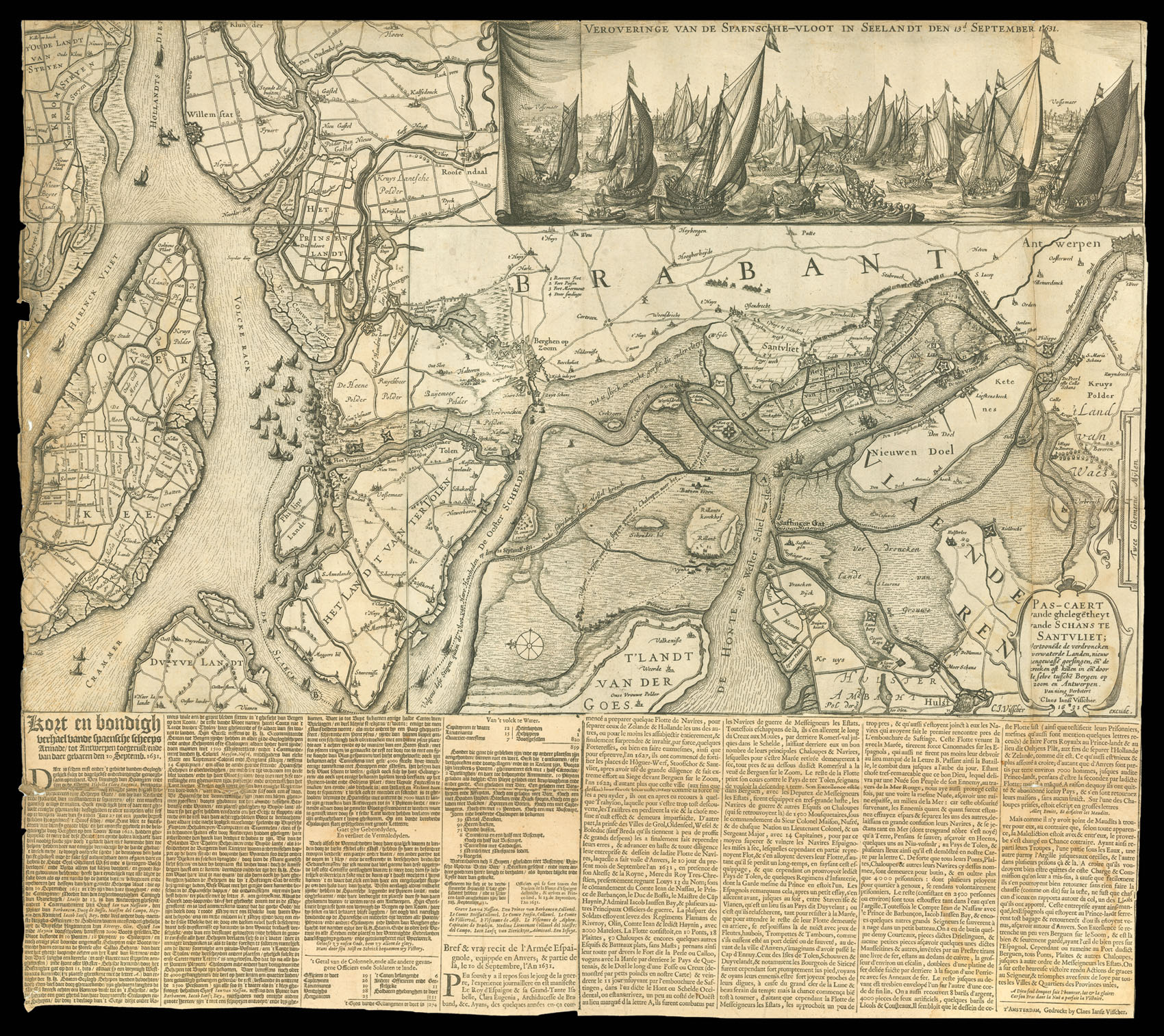
Pascaert vande ghelegēntheyt vande Schans te Santvliet Vertoonēnde de verdroncken overwaeterde Landen, nieuw aengewassēn gorsingen, ende de kreeken oft killen in ende door de selve tusschēn Bergen op zoom en Antwerpen. Van nieus Verbetert door Claes Ianss Visscher. 1631
- Author: VISSCHER, Claes Jansz
- Publication place: Amsterdam
- Publisher: Claes Jansz Visscher
- Publication date: 1631.
- Physical description: Engraved map with letterpress below.
- Dimensions: 380 by 640mm. (15 by 25.25 inches).
- Inventory reference: 11378
Notes
Very scarce news-map of the river approaches to Antwerp and the surrounding area, focusing on the defences of Zandvliet and Bergen-op-Zoom.
The map depicting a column of soldiers advancing on Zandvliet, while the naval Battle of the Slaak (12th – 13th September, 1631) is shown in miniature vignette on the coast, and in the more detailed, finely observed, inset at upper right. The battle was a decisive victory for the Dutch over a Spanish force, surprised in the Slaak of Volkerak channel, in which perhaps three-quarters of the Spanish force was sunk or captured.
The letterpress text pasted below the map is an account of the battles in Dutch and French.
Bibliography
- Campbell, Claes Jansz. Visscher, 80
- Simon, Claes Jansz. Visscher, 271.
Biography
VISSCHER, Claes Jansz 1587 - 1652
Related items
Find Us
New York
PO Box 329, Larchmont, NY, USA
Opening hours, London Gallery
Monday to Friday: 10:00 – 18:00
Saturday: by appointment
Closed: all bank holidays and 1-31 August
Opening hours, New York
By appointment only
 Rare Maps
  Rare Atlases
  Rare Books
  Rare Prints
  Globes and Planetaria


