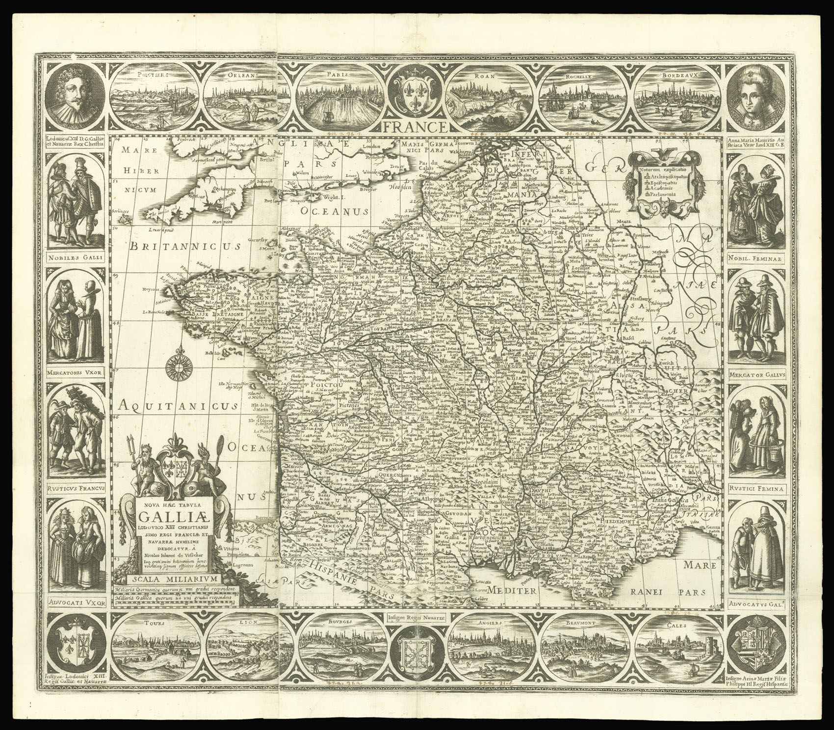
France. Nova Haec Tabula Galliae...
- Author: VISSCHER, Claesz Jansz
- Publication place: [?Venice
- Publication date: 1642].
- Physical description: Double-page engraved map, decorative border of peoples, and cities to borders.
- Dimensions: 460 by 540mm (18 by 21.25 inches).
- Inventory reference: 10739
Notes
An unrecorded pirated Italian edition of Claesz Jansz Visscher’s carte-a-figures map of France.
Gunther Shilder, in the introduction to his cartobibliography of Dutch folio-sized maps with decorative borders (sometimes termed cartes a figures, or ‘panelled maps) commented “this genre must be considered one of the finest products of the Amsterdam map-making industry. The successful combination of advances in geographical knowledge with the expression of artistic capability made these maps a valued commodity on both the domestic and broader international market.
That many of these maps were sold as separate sheets, and were only randomly inserted into composite-style atlases of the period, accounts for their rarity today, while their aesthetic appeal has not diminished over the centuries, making them highly collectable examples of the mapmaker’s art.
Although the present map bears no date, and is clearly a copy of the Dutch original, it is possible that it was engraved in Venice, perhaps by the little known publisher Stefano Scolari. There are several reasons to back up this case. Firstly, the paper used in the printing bears the water mark of an anchor in a circle, summounted by a six-pointed star (Heawood 8?) which indicates the paper to be Italian and of the period; secondly the map appeared together with six other similar examples at a Sotheby’s auction, several of which bore the date 1642, and had numerous vignette views to the borders reversed, so that the Tower of London appeared on the left rather than the right of the image, however, this error is not present on the views of Venice, Rome and Constantinople which appear on the map of Europe.
The map is based upon Claesz Jansz Visscher’s map of France initially published around 1620. The title France appears in the centre of the decorative top border, and a large cartouche with the second title in nine lines fills up the lower left corner. To the upper right is a cartouche with the legend of the symbols used upon the map. The map is surrounded by a decorative border of coats-of-arms, town views and costumed figures. To the upper right and left are portraits of Louis XIII and his consort Anna Maria.
The present map differs from the 1620 Visscher map, by the amending of the two portraits for depictions of the pair as children to them as adults.
Bibliography
- c.f. Shilder 82.1 for Visscher c.1620 map.
 Rare Maps
  Rare Atlases
  Rare Books
  Rare Prints
  Globes and Planetaria


