 Rare Maps
  Rare Atlases
  Rare Books
  Rare Prints
  Globes and Planetaria
 Sign up to hear about our latest acquisitions, exhibitions and events


Find Us
New York
PO Box 329, Larchmont, NY, USA
Opening hours, London Gallery
Monday to Friday: 10:00 – 18:00
Saturday: by appointment
Closed: all bank holidays and 1-31 August
Opening hours, New York
By appointment only
Opening hours

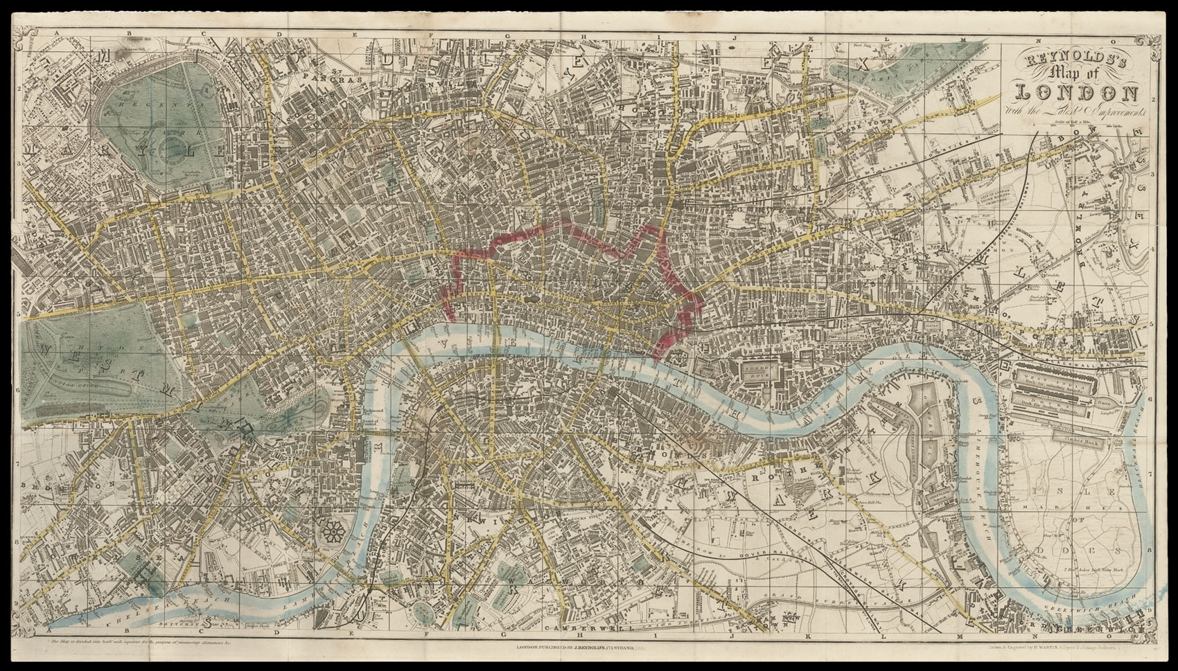
Reynolds's Map of London with the Latest Improvements.
- Author: REYNOLDS, James
- Publication place: London
- Publisher: J. Reynolds, 174 Strand
- Publication date: 1851.
- Physical description: Hand-coloured engraved folding map, 'Drawn and Engraved by H. Martin, 8 Dyers Buildings, Holborn'; a few old tears but generally an attractive map, together with the booklet of 22, [14] with an inserted outline map of "exhibition Chief Objects of Interest in London"; folding into original cloth boards, the upper cover with a green printed label 'The Exhibition Map of London and Visitors Guide. price 1s 6d Colored.'
- Dimensions: 435 by 770mm (17.25 by 30.25 inches).
- Inventory reference: 1571
Notes
An attractive map and guide to London produced for visitors during the Great Exhibition.
The plan shows the Crystal Palace, which occupies a large part of the southern portion of Hyde Park. Railways and are clearly marked in black with main roads coloured yellow, open spaces in green, and the City of London outlined in red. A booklet accompanies the map, which contains a great deal of information for the ‘Stranger’ to London. It advises him that he must be “vigilant and circumspect… lest he become the prey of some of the swarms of knaves”. After frightening the poor tourist half to death, the guide goes on to list the various amusements and sights the city has to offer. Most notable among its attractions is the Great Exhibition, which if one wishes to go to the opening day will cost a gentleman £3 3s and a lady £2 2s.
Scale: 4 inches to 1 statute mile.
Bibliography
- Howgego 406 (3).
Related items


Sign up to hear about our latest acquisitions, exhibitions and events
Find Us
New York
PO Box 329, Larchmont, NY, USA
Opening hours, London Gallery
Monday to Friday: 10:00 – 18:00
Saturday: by appointment
Closed: all bank holidays and 1-31 August
Opening hours, New York
By appointment only