 Rare Maps
  Rare Atlases
  Rare Books
  Rare Prints
  Globes and Planetaria
 Sign up to hear about our latest acquisitions, exhibitions and events


Find Us
New York
PO Box 329, Larchmont, NY, USA
Opening hours, London Gallery
Monday to Friday: 10:00 – 18:00
Saturday: by appointment
Closed: all bank holidays and 1-31 August
Opening hours, New York
By appointment only
Opening hours

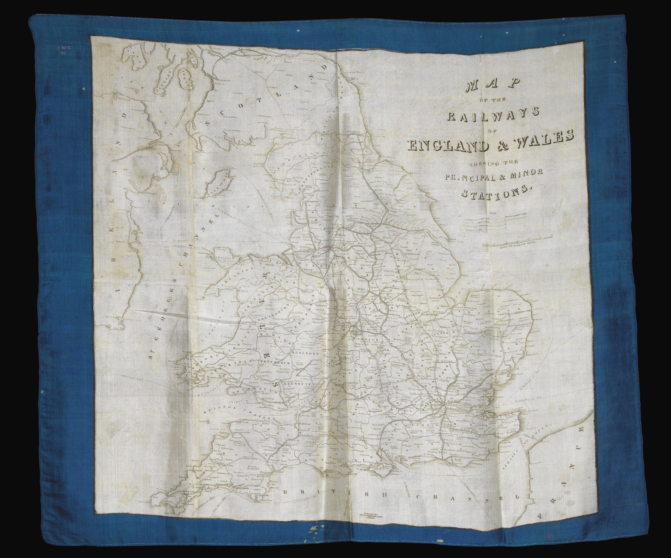
Map of the Railways of England & Wales shewing the principal and minor stations.
- Author: WELCH, MARGETSON & CO
- Publication place: London
- Publisher: Printed by Welch & Margetson
- Publication date: c1845
- Physical description: Lithographed map printed on silk, blue border, embroidered initials at upper left.
- Dimensions: 800 by 930mm. (31.5 by 36.5 inches).
- Inventory reference: 14140
Notes
A souvenir map of England and Wales, showing the railway lines rapidly spreading across the country. Although the map is undated, the ownership embroidery (“I.W.C. 45”) and the progress of the lines allows a fairly accurate estimate of the date of production. The railway line from London to Exeter is completed (1844), but not the extension to Plymouth (1846); similarly, the line to Colchester is finished (1843) but not the extension to Ipswich (1846).
Welch, Margetson & Co was a successful clothing manufacturer and wholesaler from 1842 to 1963. Maps printed on silk were popular contemporary accessories, with a similar silk railway map printed by William Reed. Welch and Margetson also produced a silk map of London, an example of which is in the Victoria and Albert Museum.
Bibliography
- See V&A T.84-1972 for another example of the firm's work.
Related items


Sign up to hear about our latest acquisitions, exhibitions and events
Find Us
New York
PO Box 329, Larchmont, NY, USA
Opening hours, London Gallery
Monday to Friday: 10:00 – 18:00
Saturday: by appointment
Closed: all bank holidays and 1-31 August
Opening hours, New York
By appointment only