 Rare Maps
  Rare Atlases
  Rare Books
  Rare Prints
  Globes and Planetaria
 Sign up to hear about our latest acquisitions, exhibitions and events


Find Us
New York
PO Box 329, Larchmont, NY, USA
Opening hours, London Gallery
Monday to Friday: 10:00 – 18:00
Saturday: by appointment
Closed: all bank holidays and 1-31 August
Opening hours, New York
By appointment only
Opening hours

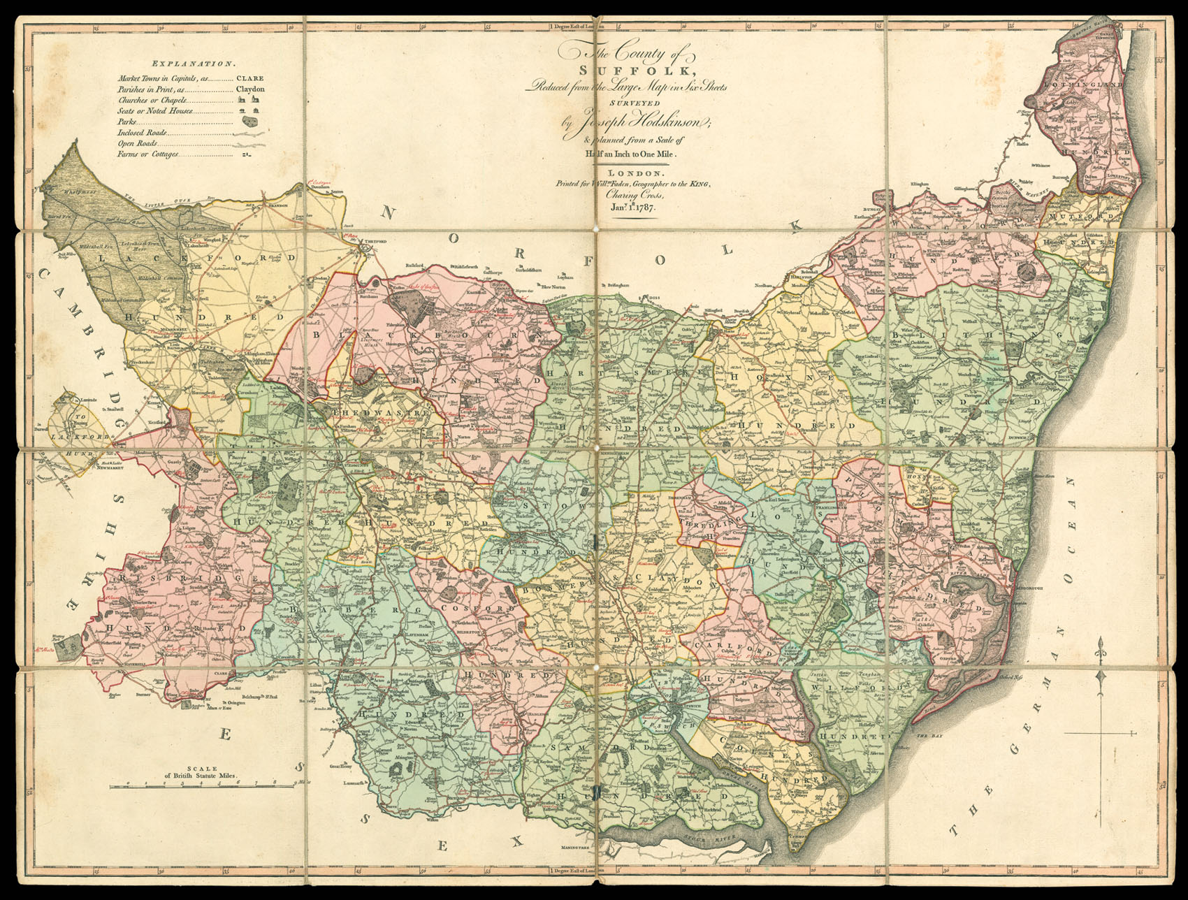
The County of Suffolk, Reduced from the Large Map in Six Sheets Surveyed by Joseph Hodskinson; & planned from the Scale of Half an Inch to One Mile.
- Author: HODSKINSON, Joseph
- Publication place: London
- Publisher: Printed for Will[ia]m Faden, Geographer to the King, Charing Cross
- Publication date: Jany. 1st, 1787
- Physical description: Engraved map, fine original full-wash colour, dissected and mounted on linen, housed within original cloth slipcase, with publisher's label.
- Dimensions: 585 by 785mm (23 by 31 inches).
- Inventory reference: 1930
Notes
Proposals for Hodskinson’s map of Suffolk were published in March 1780 with an apology for the delay caused by the death of his assistant, Andrew Dury, in 1778. It was anticipated that the map would be published in 1781 for 1 1/2 guineas but it was 1783 before it finally appeared. Hodskinson had already engraved large-scale surveys of Bedfordshire in 1765, for Thomas Jefferys, and Cumberland in 1771 for Donald – he followed this up by surveying the county of Suffolk himself. It was engraved by William Faden who was always less flamboyant than such predecessors as Rocque and Jefferys. If the decoration is a little severe, one cannot fault the detail and it well deserved its award from the Society of Arts of a Gold Medal.
The single sheet reduction gives information on market towns, parishes, churches and chapels, seats or noted houses, parks, enclosed roads, open roads, farms, and cottages. Also marked upon the map in manuscript are the names of the gentry to whom the various notable houses belong.
Scale: half an inch to 1 statute mile.
Related items


Sign up to hear about our latest acquisitions, exhibitions and events
Find Us
New York
PO Box 329, Larchmont, NY, USA
Opening hours, London Gallery
Monday to Friday: 10:00 – 18:00
Saturday: by appointment
Closed: all bank holidays and 1-31 August
Opening hours, New York
By appointment only