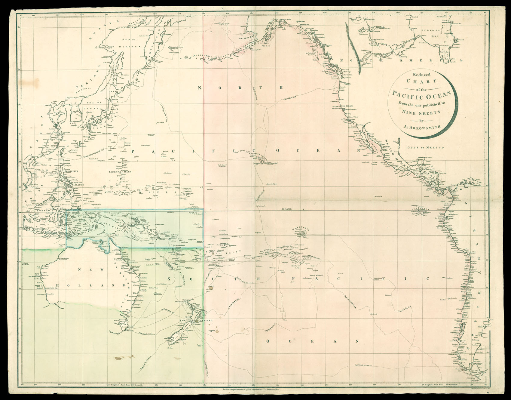
Reduced Chart of the Pacific Ocean from the one published in Nine Sheets by A. Arrowsmith.
- Author: ARROWSMITH, Aaron
- Publication place: London
- Publisher: Published A. Arrowsmith No.24 Rathbone Place
- Publication date: October, 1st, 1798.
- Physical description: Engraved chart, with fine original full-wash colour.
- Dimensions: 640 by 820mm (25.25 by 32.25 inches).
- Inventory reference: 11886
Notes
Rare reduction of Arrowsmith’s nine sheet chart of the Pacific Ocean.
One of the first charts of the Pacific to chart the discoveries of Captain Cook. All three of Cook’s voyages are marked, as is his death on Hawaii. Two unmarked tracks are shown from Java to Tasmania (Van Diemans Land); neither of which are marked on the examples housed in the Library of Congress or the National Library of Australia. The chart is divided into three coloured zones: pink for the eastern Pacific; green from latitude 15o south, covering Australia and New Zealand; and a small blue box from east of the Celebes to the international date line, and north to just above the equator. Although it is unclear why the chart is so coloured, it is possible that the green and blue areas mark out British and French spheres of influence, at the beginning of the eighteenth century.
Aaron Arrowsmith (1750-1823), ”easily the foremost cartographer of his time” (R.V. Tooley), was the founder of the Arrowsmith dynasty of cartographers. Born in County Durham, he was in London by 1777 when he witnessed the will of Andrew Dury, a mapseller and publisher, and was probably training with him; he may have trained with William Faden, Geographer to the King, but was certainly employed by John Cary in 1782, as he is credited with the survey work for ’Cary’s Actual Survey, of the Great Post Roads between London and Falmouth’, published in 1784; he is frequently credited with some of the survey work for Cary’s county atlas, ’Cary’s New and Correct English Atlas: being a set of county maps from actual surveys’ (1787), but the sources are silent on this and by this time Arrowsmith had established his own business.
Arrowmsith’s maps set a new standard; he was assiduous in analysing and verifying his sources, discarding not only the fictional but also the uncertain, going to printed and manuscript sources for his information, and engraved in a clear and highly legible style. Arrowsmith was also diligent in revising and improving his maps to keep them current, and served as an inspiration for the next generation of (particularly American) surveyors.
We have only been able to trace two copies of this edition of the map with the two unmarked tracks: Bibliothèque nationale de France, and the British Library.
 Rare Maps
  Rare Atlases
  Rare Books
  Rare Prints
  Globes and Planetaria


