- Home
-
Browse
-
Discover
-
About
Find Us
New York
PO Box 329, Larchmont, NY, USA
Opening hours, London Gallery
Monday to Friday: 10:00 – 18:00
Saturday: by appointment
Closed: all bank holidays and 1-31 August
Opening hours, New York
By appointment only
Opening hours

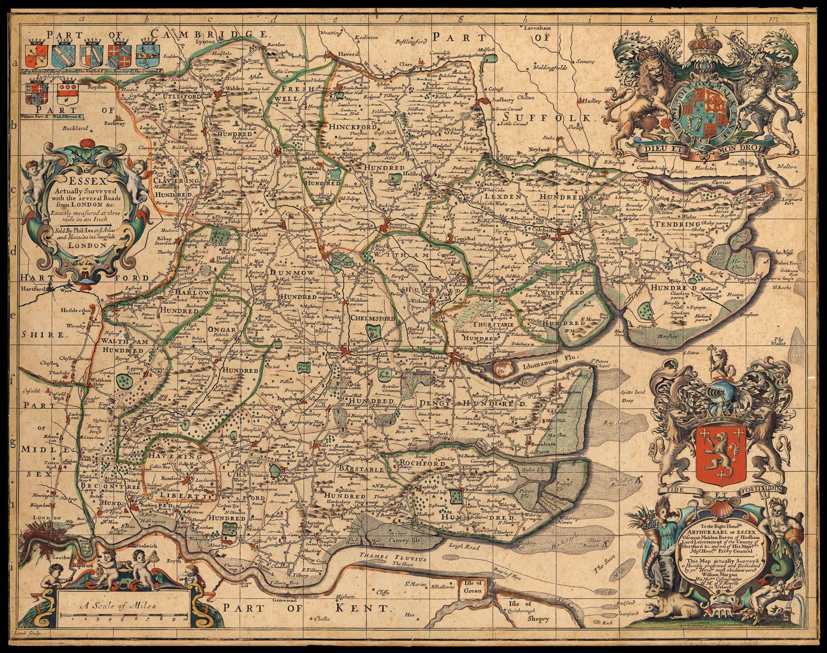
Essex Actually Surveyed with the several Roads from London &c. Exactly measured at three mile in an Inch.
- Author: MORGAN, William and John Ogilby
- Publication place: London
- Publisher: Sold By Phil. Lea at ye Atlas and Hercules in Cheapside
- Publication date: c.1689
- Physical description: Hand-coloured double-page engraved map, trimmed to within neatline.
- Dimensions: 430 by 540mm. (17 by 21.25 inches).
- Inventory reference: 1635
Notes
A new state of the map by John Ogilby and William Morgan (first published in 1678), with Ogilby’s name and date removed and Lea’s imprint inserted, but Morgan’s dedication to Arthur, Earl of Essex, retained. By this point the plate had been acquired by Philip Lea who published it in this edition of the Saxton atlas of c. 1689.
Bibliography
- Skelton 110.
Skelton, R. (1978). County Atlases of the British Isles 1579-1850. Folkestone: Dawson.
Related items
Find Us
New York
PO Box 329, Larchmont, NY, USA
Opening hours, London Gallery
Monday to Friday: 10:00 – 18:00
Saturday: by appointment
Closed: all bank holidays and 1-31 August
Opening hours, New York
By appointment only
 Rare Maps
  Rare Atlases
  Rare Books
  Rare Prints
  Globes and Planetaria


