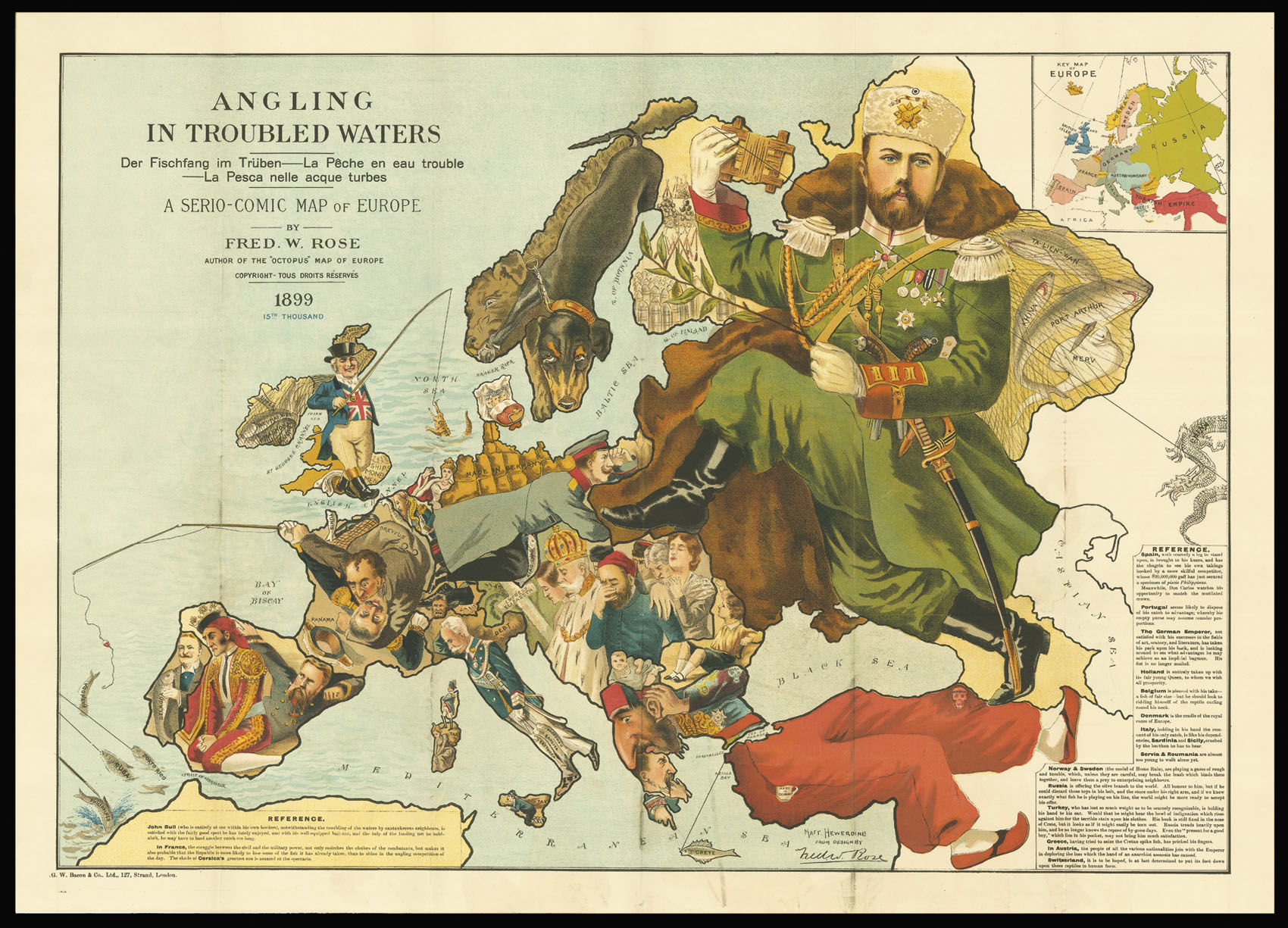
Angling in Troubled Waters Der Fischfang im Trüben – La Pêche en l’eau trouble – La Pesca nelle acque turbes. A Serio-Comic Map of Europe By Fred W. Rose. Author of the “Octopus” map of Europe Copyright – Tous Droits Réservés 1899. 15th Thousand.
- Author: ROSE, Fred W
- Publication place: London
- Publisher: G. W. Bacon & Co. Ltd., 127 Strand
- Publication date: 1899.
- Physical description: Chromlithograph map, inset map of Europe upper right, key to map lower right and left, folding into original green paper covers, with publisher's label.
- Dimensions: 545 by 765mm (21.5 by 30 inches).
- Inventory reference: 2840
Notes
A caricature map of Europe with each country depicted as an angler having various levels of success in hooking colonies: John Bull has a huge catch-bag (Ireland), with Egypt as a crocodile on the end of his line; France is a scuffle for control of the Third Republic between the military and civilian, their rod with an empty hook, with Napoleon’s shade looking on from Corsica; Spain is watching sadly as their former catch (fish marked Cuba, Porto Rico and Phillippines) is being dragged away on the lines of an unseen U.S.A.; Belgium has the Congo; the Austro-Hungarians are mourning the assassination of Empress Elisabeth by an anarchist; Turkey has a hook in ‘the Cretan spike fish’, and a stain on his trousers is a skull marked ‘Armenia’; Greece has pricked a finger trying to catch the spike fish by hand; larger than all others is Russia, shown as Nicholas II with an olive branch in one hand and a line stretching to the Far East in the other.
Bibliography
- HILL, Cartographical Curiosities, 57
- MCC 1, Geographical Oddities, no 82, a later state.
 Rare Maps
  Rare Atlases
  Rare Books
  Rare Prints
  Globes and Planetaria


