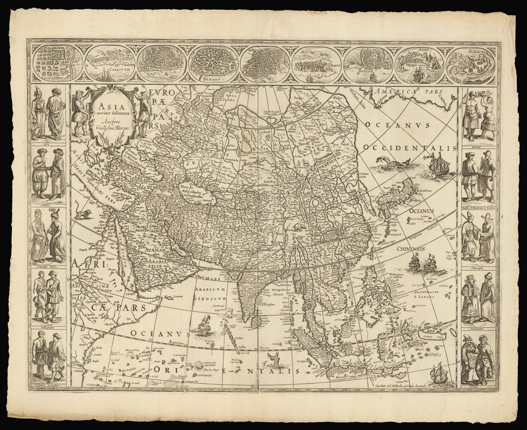
Asia novitier delineata.
- Author: BLAEU, Willem Janszoon
- Publication place: Amsterdam
- Publisher: G. Blaeu
- Publication date: 1621- 1630
- Physical description: Double-page engraved map, no text to verso.
- Inventory reference: 12241
Notes
A fine example of Blaeu’s folio carte-a-figure map of Asia, a reduction of his wall map of 1608, with the coastal cartography based on Portuguese sources. The map is a reduction of Blaeu’s wall map of 1608, with the majority of the cartography based on Portuguese mapmakers. Korea is shown as a long thin island, and much of the coast line of Borneo, Java, and Celebes is uncertain, although many of the islands that make up the Philippines are much more accurately portrayed. Japan is based on the work of Luis Teixeira.
This is the second state with the name changed in the cartouche from ‘Guil: Janssonio’ to ‘Guiljelmo Blaeu’. The map would be incorporated into Blaeu’s first atlas the ‘Appendix’ in 1630. Later states with text on the verso would appear in all Blaeu’s subsequent atlases.
Blaeu’s map of Asia captures the continent right at the critical period when the newly formed Dutch East India Company (the VOC) was challenging Portuguese hegemony in the Far East. Willem Blaeu, who would later be appointed the official hydrographer to the VOC, had access to the unrivalled map collection of Petrus Plancius, who, in addition to Dutch sources, also acquired, by way of espionage, in 1592-1594, manuscripts from Bartholemmeo de Lasso in Lisbon. Blaeu first employed these sources on his 1605 folio map of Asia. Ceylon and the Maldives are derived from Linschoten, and Java and Bali show advanced information from Willem Lodewijksz’s map during his recent voyage with De Houtman, Japan is derived from Ortelius’s 1595 map. The mythical Strait of Anian, the gateway to the Northwest Passage, appears in the northeast. In the Arctic, the recent attempts by Willem Barentsz to navigate a Northeast Passage are indicated by the appearance of the island of Nova Zembla.
The side panels contain vignettes representing the peoples of various Asian civilizations in local costume, including Syrians, Arabs, Armenians, Sumatrans, Javans, Moluccans, Chinese, Tatars, and Russians. Gerritsz was influenced by various sources including De Bry, Linschoten and Enea Vico.The top margin features bird’s-eye views from Braun & Hogenberg and Linschoten including Damascus, Jerusalem, Aden, Hormuz, Goa, Calicut, Candy, Bantam, and Macao.
Bibliography
- MCN IV 35.2.
 Rare Maps
  Rare Atlases
  Rare Books
  Rare Prints
  Globes and Planetaria


