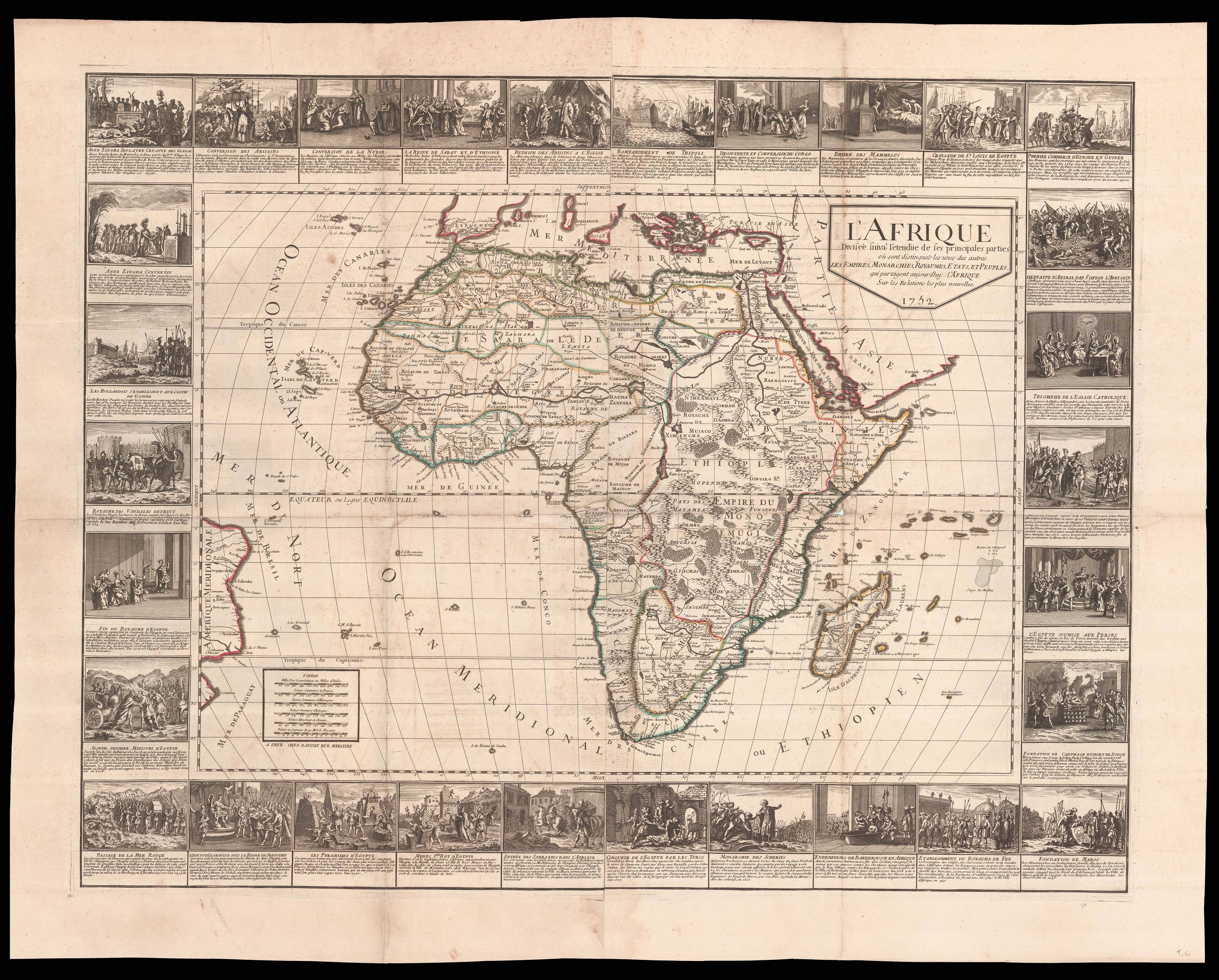
L'Afrique divisee suivant l'entendue de ses pricipales parties...
- Author: BAILLEUL, Nicolas
- Publication place: Lyon
- Publisher: Daudet
- Publication date: 1752.
- Physical description: Engraved map on two sheets joined, fine original outline colour, tears to old folds with minor loss.
- Dimensions: 780 by 1020mm (30.75 by 40.25 inches).
- Inventory reference: 16013
Notes
Rare wall map of Africa by the French cartographer Nicolas Bailleul.
Although Bailleul has based the outline of his map of Africa on Jaillot’s influential work of 1674, a template which would be re-used by numerous French cartographers and map publishers throughout the eighteenth century, the internal information has been partially updated to reflect the maps produced by the likes of Guillaume Delisle. The most notable change from the Jaillot map is the omission of the two Ptolemaic-based, Nile River source lakes, formerly shown in the area of modern day Zambia and Angola; as a result a great deal of the interior is depicted as mountainous and deeply wooded. Surrounding the map are 30 vignette scenes with text, depicting events from classical and biblical history, such as the death of Cleopatra, the defeat of Hannibal, and the parting of the Red Sea, to more recent events such as the first French trade with Guinea in 1564, the establishment of the first Dutch colony in 1630, and the bombardment of Tripoli in 1736.
Although the present map does not bear the Bailleul’s name the work can be attributed to him by the existence of a similar map of the continent of America, which bears his name and the same date. Nicolas de Bailleul (fl 1725-1765) was the youngest of a family of engravers working the first half of the eighteenth century. Like his father Gaspard and elder siblings François and Marie, Nicolas concentrated on the engraving of letters and inscriptions, and so his cartographic output is particularly rare.
The present map is rare, we are unable to trace any institutional examples.
 Rare Maps
  Rare Atlases
  Rare Books
  Rare Prints
  Globes and Planetaria


