 Rare Maps
  Rare Atlases
  Rare Books
  Rare Prints
  Globes and Planetaria
 Sign up to hear about our latest acquisitions, exhibitions and events


Find Us
New York
PO Box 329, Larchmont, NY, USA
Opening hours, London Gallery
Monday to Friday: 10:00 – 18:00
Saturday: by appointment
Closed: all bank holidays and 1-31 August
Opening hours, New York
By appointment only
Opening hours

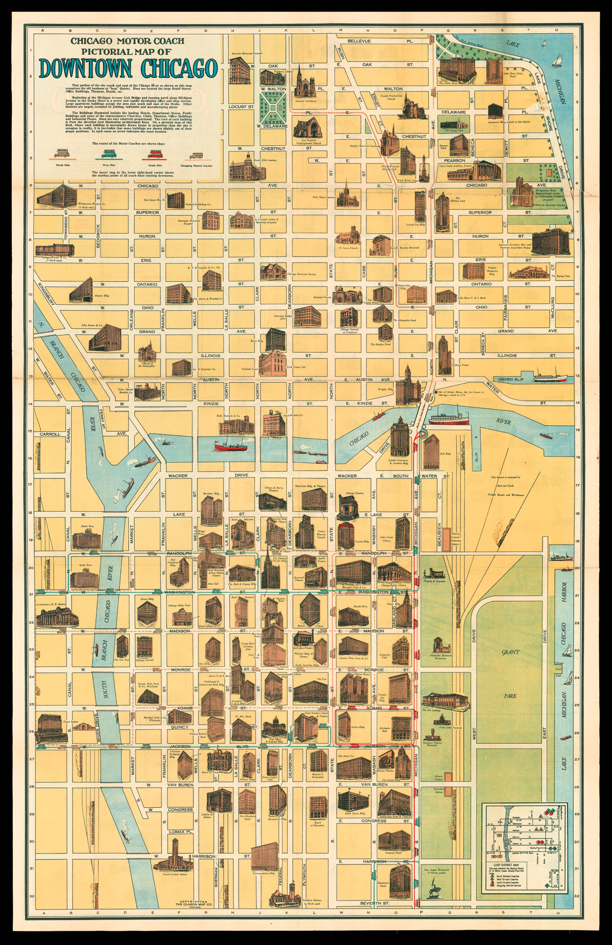
Chicago Motor Coach Pictorial Map of Downtown Chicago.
- Author: The Clason Map Company
- Publication place: Chicago
- Publisher: The Glason Map Company
- Publication date: c.1940
- Physical description: Lithographed map.
- Dimensions: 530 by 830mm. (20.75 by 32.75 inches).
- Inventory reference: 11853
Notes
A promotional map of downtown Chicago. Famous buildings are shown in profile, including hotels, churches, theatres, and newspaper offices. The small inset diagram in the lower right corner shows the “Motor Coach Routes” in the Loop, the nickname given to the transport system ring in the city. The diagram is then reproduced on the map itself, with each route shown as a differently coloured line of dashes with small drawings of coaches.
George Clason had started his original map company in Denver, after fighting in the Spanish-American War. His success in Denver led to the opening of a second branch in Chicago, to take advantage of both the developing publishing and railway industries. Clason also published the first road atlas of the United States and Canada, and a get-rich-quick manual called ‘The Richest Man in Babylon’, which is still popular today.
Related items


Sign up to hear about our latest acquisitions, exhibitions and events
Find Us
New York
PO Box 329, Larchmont, NY, USA
Opening hours, London Gallery
Monday to Friday: 10:00 – 18:00
Saturday: by appointment
Closed: all bank holidays and 1-31 August
Opening hours, New York
By appointment only