 Rare Maps
  Rare Atlases
  Rare Books
  Rare Prints
  Globes and Planetaria
 Sign up to hear about our latest acquisitions, exhibitions and events


Find Us
New York
PO Box 329, Larchmont, NY, USA
Opening hours, London Gallery
Monday to Friday: 10:00 – 18:00
Saturday: by appointment
Closed: all bank holidays and 1-31 August
Opening hours, New York
By appointment only
Opening hours

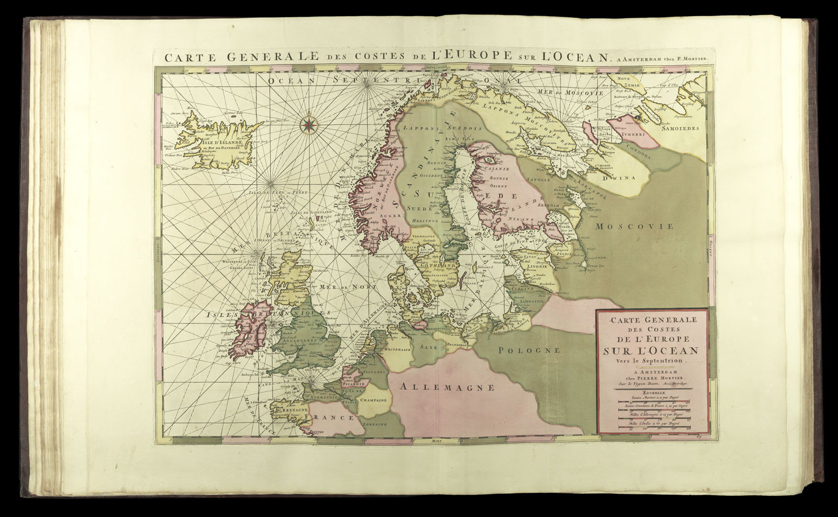
Carte Generale Des Costes De L'Europe Sur L'Ocean Vers le Septentrion
- Author: JAILLOT, Alexis Hubert [and] MORTIER, Pieter
- Publication place: Amsterdam & Paris
- Publisher: Hubert Jaillot & Pierre Mortier
- Publication date: 1693–1708.
- Physical description: Engraved map in full original hand-colour heightened in gold
- Inventory reference: 4254
Notes
A map of western Europe.
The “most expensive sea-atlas ever published in Amsterdam in the seventeenth century” (Koeman)
This monumental atlas is made up of three works: ‘Le neptune François’; ‘Cartes marines a l’usage des armées du Roy de la Grande Bretagne’; and ‘Suite du neptune François’. The first two parts were first published by Mortier in 1693, the third was issued by him in 1700.
The first part contains all 12 plates of naval ensigns and 31 charts (two more than called for by Koeman), which detail European waters from the Baltic to Portuguese coast. They are not only more lavish than any of those produced previously, but also are drawn upon Mercator’s Projection – only the second sea atlas to do so. The two extra charts are Mortier’s world map of 1693, and a chart of Europe’s Atlantic coast.
Bibliography
- Koeman M. Mor. 2, 4, & 7
- Shirley, World, 559
- Pastoureau, Neptune Français Ba
- Shirley, BL, M.MORT-1a, M.MORT-2a, & M.MORT-3a.
Related items


Sign up to hear about our latest acquisitions, exhibitions and events
Find Us
New York
PO Box 329, Larchmont, NY, USA
Opening hours, London Gallery
Monday to Friday: 10:00 – 18:00
Saturday: by appointment
Closed: all bank holidays and 1-31 August
Opening hours, New York
By appointment only