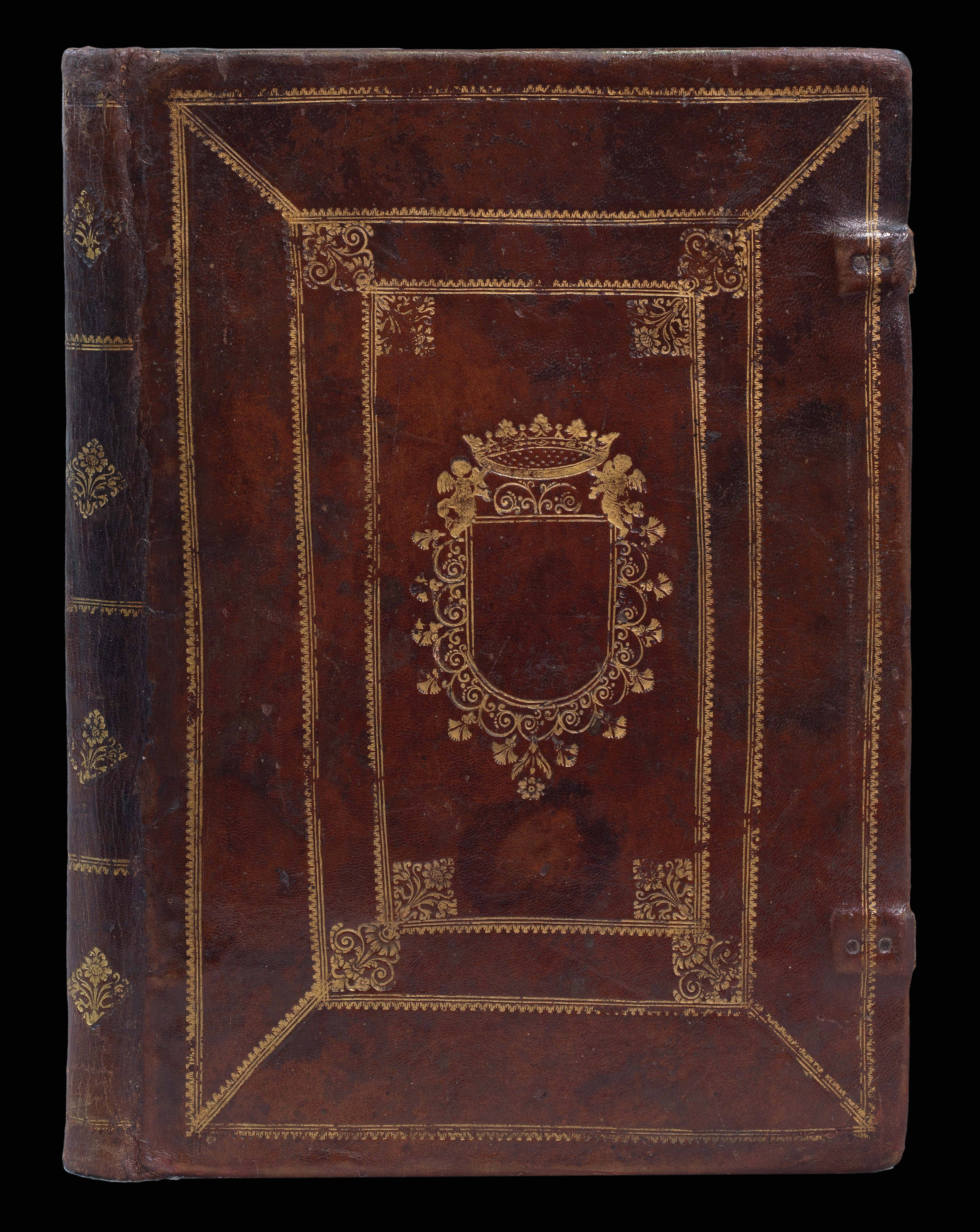


Isolario di Benedetto Bordone nel qual si ragiona di tutte l’Isole del mondo, con li lor nomi antichi & moderni, historie, fawle, & modi del loro viere, & in qual parallelo & dima giaciono. Ricorretto et di Nuovo ristampato. Con la gionta del Monte del Oro noiamente ritrouto.
- Author: BORDONE, Benedetto di
- Publication place: Venice
- Publisher: Francesco di Leno
- Publication date: c1565
- Physical description: Small folio, [10], title-page printed within woodcut borders, full-page diagram, 112 woodcut maps (of which seven are double-page), full contemporary calf, covers panelled with gilt stylised roll, foliate corner pieces, blank coat of arms, surmounted with a coronet.
- Dimensions: 300 by 202mm. (11.75 by 8 inches).
- Inventory reference: 16375
Notes
A particularly fine example of Bordone’s ‘Isolario’ in a fine contemporary binding.
Bordone’s work is particularly important from an Americanist point of view, as it contains the “gionta del Monte del Oro novamente ritrovato” mentioned on the titlepage, the earliest authentic description of Pizzaro’s entry into Peru to appear in a printed book.
The isolario, or “book of islands”, was a cartographic form introduced and developed in Italy during the fifteenth and sixteenth centuries. Like the portolano, or pilot-book, to which it was related, it had its origin in the Mediterranean as an illustrated guide for travellers in the Aegean archipelago and the Levant. Bordone’s ‘Isolario’ was the second isolario to be printed and the first to give prominence to the transatlantic discoveries.
Divided into three books, the ‘Isolario’ is devoted, respectively, to the “islands and peninsulas” of the western ocean, to the Mediterranean, and to islands of the Indian Ocean and the Far East. While this order corresponds very roughly to that of Ptolemy, it gives conspicuous priority to the discoveries across the Atlantic. In addition to a page of diagrams illustrating the construction of a circular world map and wind roses of “ancient” and “modern type”, there are three general maps: Europe, the Aegean, and an oval world map. The work also contains 107 small maps, plans, or views, including a nearly three-quarter page plan of Mexico City before the conquest of Cortez – which qualifies because it is an island. According to Cortazzi, the ‘Isolario’ also contains the earliest European printed individual map of Japan.
Bibliography
- Shirley, World, 59.
- Shirley, BL, T.BORD-1e
 Rare Maps
  Rare Atlases
  Rare Books
  Rare Prints
  Globes and Planetaria


