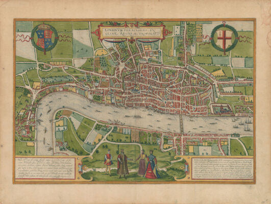
Foreigners, rich or poor, have always been a source of envy and fear, from the ‘non-doms’ in the City to the illegal immigrant or asylum seeker. Yet their influence upon London has been immeasurable, and is borne out by these plans. The Hanseatic League – arguably the first ‘non-doms’ – was responsible for commissioning one of the first maps of London in 1572.
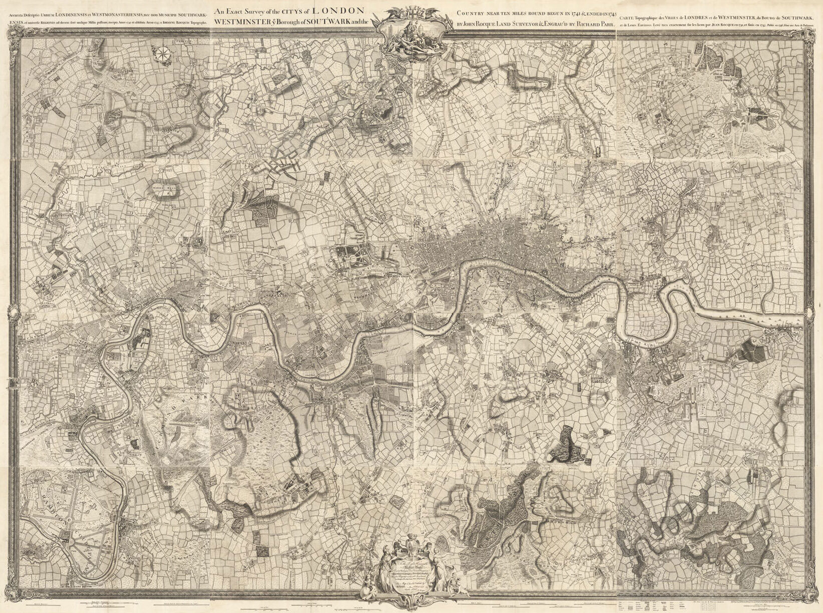
Some 100 years later, another stranger, the great Czech engraver Wenceslaus Hollar, was working on Morgan and Ogilby’s seminal plan of post-Fire London; the first true plan of the city. Finally, one must mention the French Huguenot John Rocque, who moved to London at the beginning of the eighteenth century to avoid religious persecution. His series of plans of London on one, four, eight, 16 and 24 sheets, set new standards in the mapping of London.
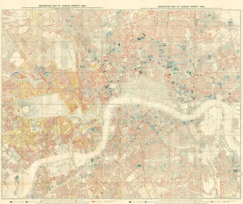
Wealth features prominently in the mapping of the city: from Thomas Porter’s depictions of the riverside palaces of the rich, to the, now lost, aristocratic town houses of the eighteenth century; one of particular note is Arlington House where the first cup of tea was supposedly brewed. The tea must have helped Londoners wash down the vast quantities of food they consumed. Perhaps unsurprisingly, the presence of the poor featured less prominently on the early mapping of the capital, that is until Charles Booth’s landmark ‘Poverty Map’ of 1882, which recorded the distribution of wealth, with the most destitute described unflatteringly as ‘vicious, semi-criminal’.
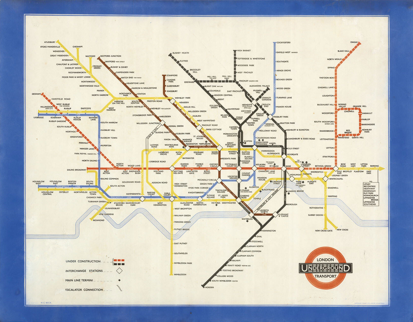
What all these plans have in common is the wish to render the chaotic city intelligible, in order that even a stranger could navigate London’s labyrinthine streets; a wish that is repeated in many of the plans’ titles. The greatest exponent of such clarity surely was Harry Beck, an engineering draftsman at the London Underground Signals Office, who created the famous tube map in 1933.