
Ottoman maps from the Sinai and Palestine campaign
Layouts and positions of coast.
- Author: OMIT, Yildirum Hassan Hussein
- Publication place: [?Constantinople],
- Publisher: Military Printing Press,
- Publication date: 1337 [1918].
- Physical description: Two lithographed maps printed in colours. Maps 3000
- Dimensions: 420 by 575mm. (16.5 by 22.75 inches).
- Inventory reference: 21681
Notes
In the blend of Arabic and Turkish that formed the official language of the Ottoman Empire, these maps list Yildirum Hassan Hussein Omit as their author. Yildirim is not a name but rather means 'thunderbolt' in Ottoman Turkish, and probably indicates that Omit was part of the Yildirim Army Group that was established in 1917 and contained troops from the German Asia Corps. The Group engaged in the Sinai and Palestine Campaign between 1915 and the end of the First World War, and was defeated by the Allies at the Battle of Megiddo in 1918, which took place in northern parts of Ottoman Palestine, as well as in Syria and Jordan. The Ottoman Empire used the Islamic Hijri calendar, with the date of 1337 that appears on both maps corresponding to 1918 on the Gregorian calendar.
The maps present the battleground of the Sinai and Palestine campaign at two distinct points, in December 1915 (Maps One and Two), and then in November 1917 (Maps Three and Four). Keys on each sheet explain that Ottoman positions and movements are shown in red, British in blue. Maps One and Two show the "General situation of the Sinai front in 1333", i.e. 1915, with British and Ottoman camps, advances, and retreats indicated.
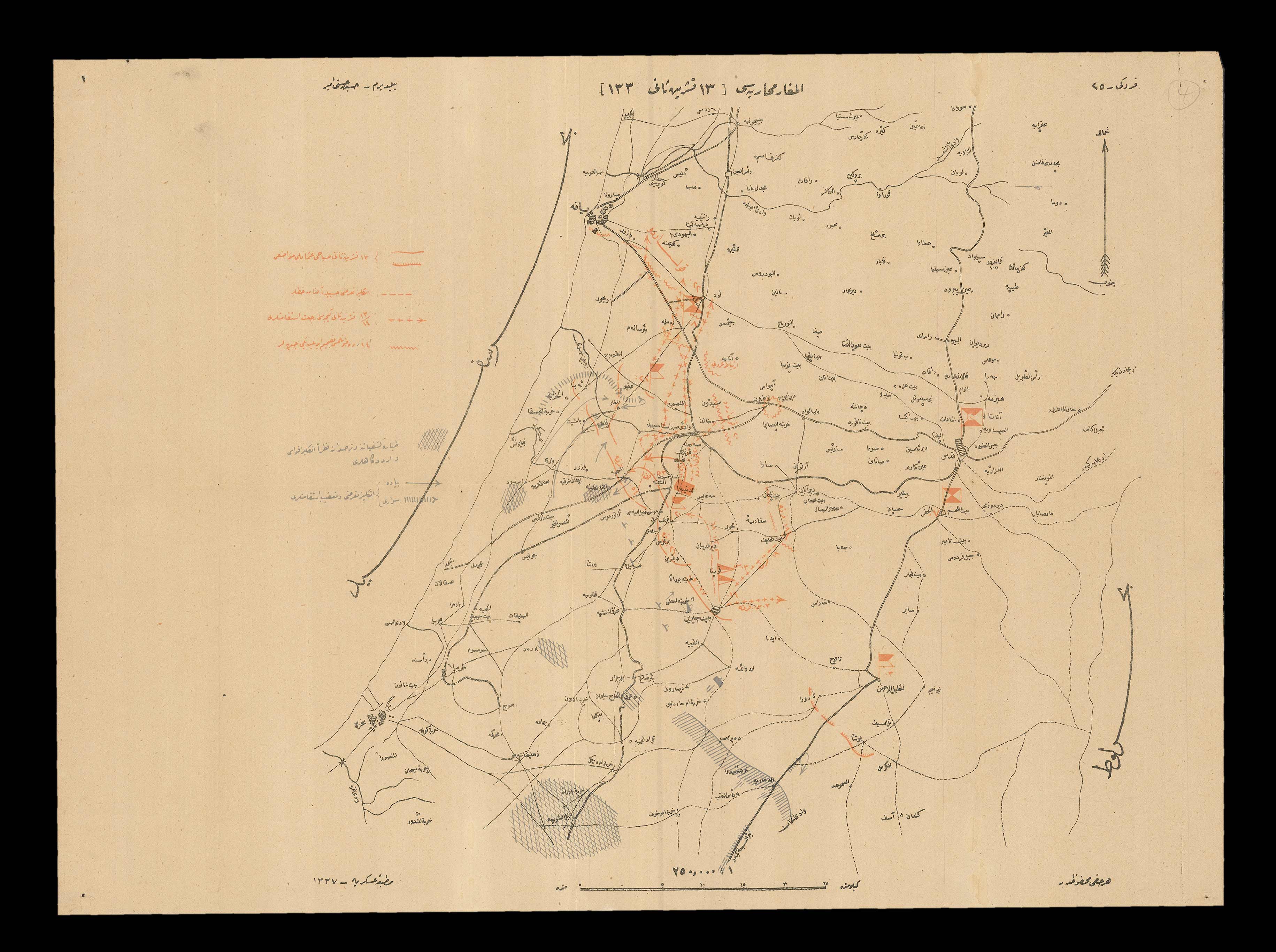
Map Three shows the British beginning to make advances towards Jaffa and the Judean Hills. Red straight and hatched lines show the Ottoman position in the morning, plus-signs describe the movement that occurred overnight, and zigzagged lines, places that the Ottomans were forced to yield. In blue, grids are zones from which British aeroplanes collected information, while arrows outline the British attack.
Map Four is precisely dated to November 13th, the day on which the Ottoman forces yielded Jaffa and withdrew to defend the capital, which their opposition would capture the following month. This map mentions December in its title, and thus shows the continuation of the British campaign, and its ultimate capture of Jerusalem, which appears on the right-hand side of the map surrounded by notes and annotations.
Image gallery
/
 Rare Maps
  Rare Atlases
  Rare Books
  Rare Prints
  Globes and Planetaria


