
Early Victorian London
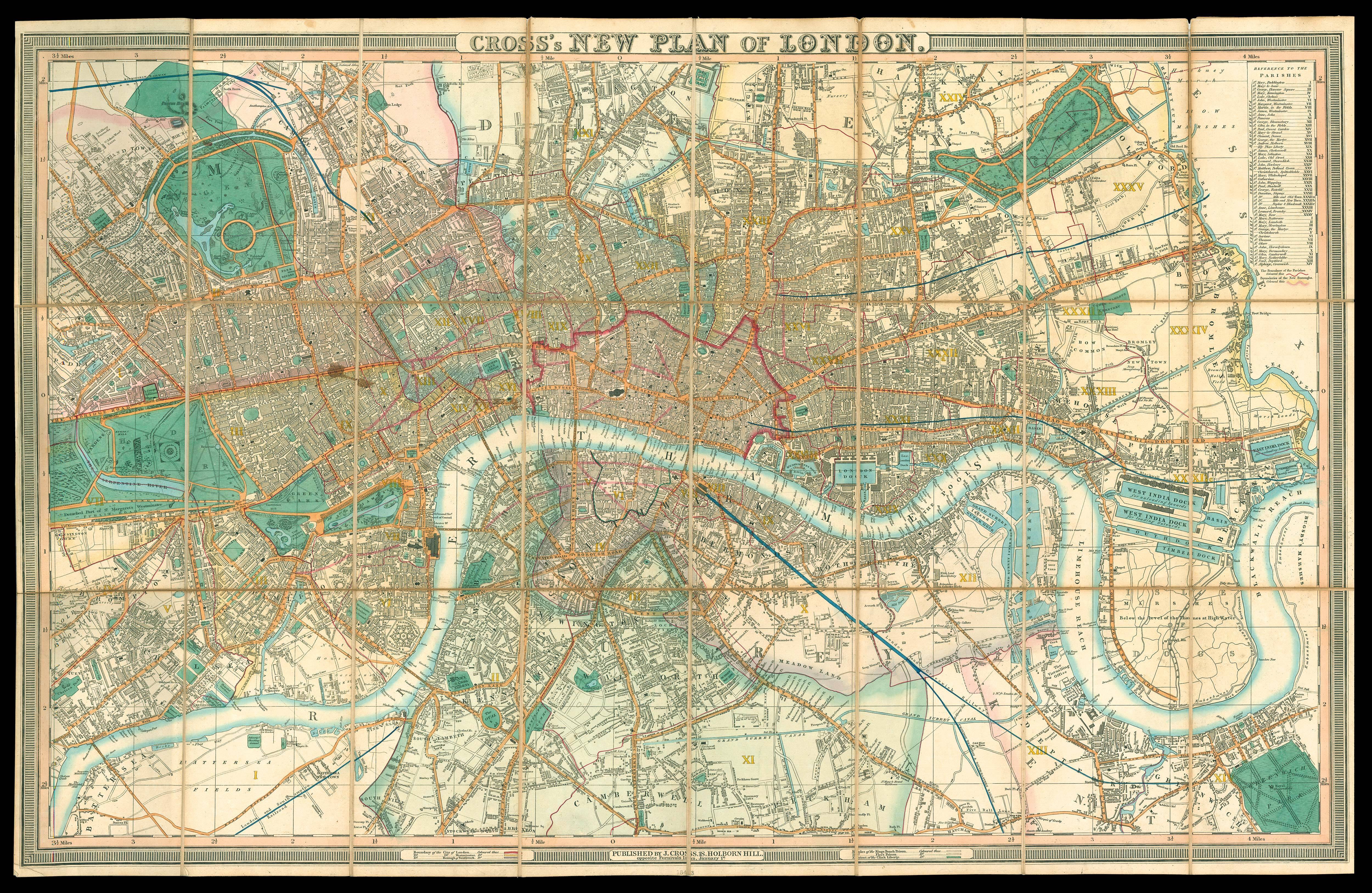
Cross's New Plan of London.
- Author: CROSS, J[oseph]
- Publication place: London,
- Publisher: Published by J. Cross 18 Holborn Hill opposite Furnivals Inn,
- Publication date: January 1st [c.1843].
- Physical description: Large engraved map, fine original hand-colour, dissected and mounted on linen, references to parishes upper right, housed within original brown cloth slipcase, with publisher's label of Letts & Son, rubbed.
- Dimensions: 650 by 1010mm (25.5 by 39.75 inches).
- Inventory reference: 1928
Notes
Large and detailed plan of early Victorian London.
The boundaries of Cities of London, Westminster, and Southwark are shown; as are the Rules of the Kings Bench Prison, Fleet Prison, and the extent of the Clink Liberty. To the upper right is a table of London parishes, which are marked on the plan by Roman Numerals. Also marked are their boundaries, and the extent of the Two Penny Post, and the limits of the Hackney Coach.
To the east of the City lies the newly opened Victoria Park, which would later, in Victoria's reign, become know as "The People's Park". In Westminster the ground plan of Charles Barry's neo-gothic Houses of Parliament can be seen; together with Isambard Kingdom Brunel's newly opened Hungerford Bridge.
Scale: 4 1/2 inches to 1 statute mile.
Bibliography
- Howgego 317 (9).
Image gallery
/
 Rare Maps
  Rare Atlases
  Rare Books
  Rare Prints
  Globes and Planetaria


