 地图
地图  地图集
地图集  珍本
珍本  版画
版画  天文仪器
天文仪器 注册以了解我们最新的收购、展览和活动


地址
纽约
PO Box 329, Larchmont, NY, USA
开放时间,伦敦画廊
周一至周五:10:00-18:00
周六请预约
公休日:所有银行假日以及 8月1日至31日
营业时间,纽约
仅限预约

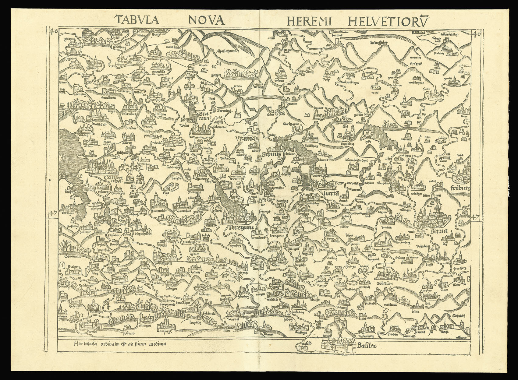
The first 'modern' printed map of Switzerland
Tabvla Nova Heremi Helvetiorv.
- 作者: WALDSEEMULLER, Martin
- 出版地: [Strasburg
- 发布日期: 1513].
- 物理描述: Double-page woodcut map.
- 方面: 620 by 450mm. (24.5 by 17.75 inches).
- 库存参考: 2634
笔记
Waldseemuller’s ‘modern’ map of Switzerland published in the seminal atlas of 1513.
Along with the twenty-seven Ptolemaic maps, Waldseemüller also added a second section of twenty modern maps, which was the first major attempt to break away from the Ptolemaic tradition. The present map of Switzeraland, is the first modern – i.e. non-Ptolemaic – map of the county. It differs stylistically from the other modern maps and was probably adapted from a manuscript map by Konrad Türst of circa 1495.
相关项目


/
请注册以了解最新珍品、展览和活动信息
地址
纽约
PO Box 329, Larchmont, NY, USA
开放时间,伦敦画廊
周一至周五:10:00-18:00
周六请预约
公休日:所有银行假日以及 8月1日至31日
营业时间,纽约
仅限预约