 地图
地图  地图集
地图集  珍本
珍本  版画
版画  天文仪器
天文仪器 注册以了解我们最新的收购、展览和活动


地址
纽约
PO Box 329, Larchmont, NY, USA
开放时间,伦敦画廊
周一至周五:10:00-18:00
周六请预约
公休日:所有银行假日以及 8月1日至31日
营业时间,纽约
仅限预约

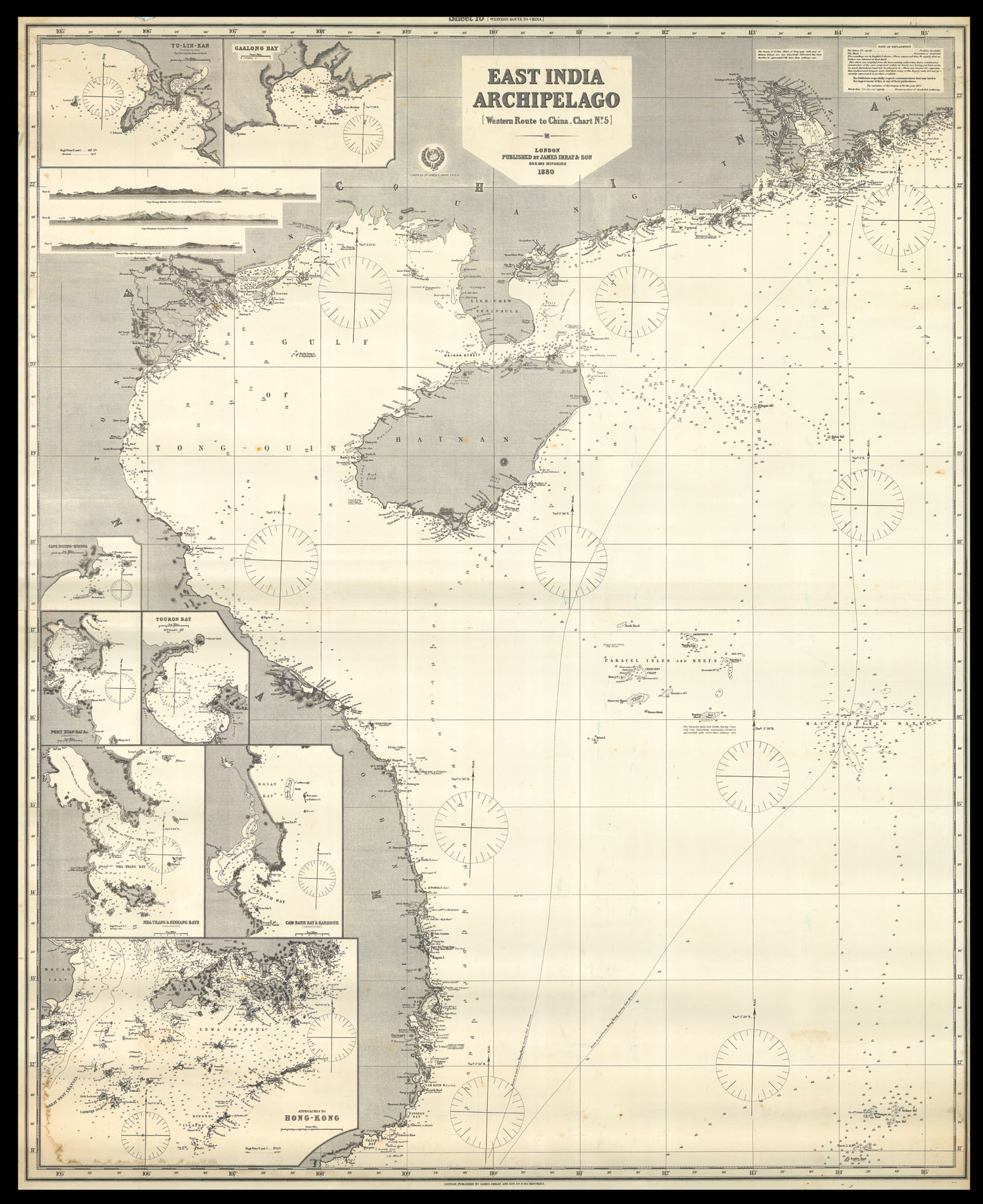
East India Archipelago Western Route to China. Chart No.5.
- 作者: IMRAY, James
- 出版地: London
- 出版商: James Imray & Son
- 发布日期: 1880.
- 物理描述: Engraved chart, backed on blue paper.
- 方面: 1245 by 1015mm. (49 by 40 inches).
- 库存参考: 11960
笔记
A large blue-backed chart of Vietnam, Hainan Island and southwest China, showing two potential routes to Hong Kong during the monsoon. There are inset maps of ports along the South China Sea coasts, including Hong Kong, Touron Bay (now known as Da Nang) and Ganlong Bay (now known as Ha Long Bay), and some coastal views to the upper left. This is the fifth in a set of six maps which illustrate the route to China via the Pacific.
James Imray (1803-1870), worked originally in the stationery and account book publishing business. In 1836 Imray joined with Michael Blachford. The partnership flourished and soon began to compete with the larger firm of Norie and Wilson. In 1846 Imray bought out Blachford, and the company survived, led by his descendants, into the twentieth century, when it merged with Norie and Wilson.
相关项目


请注册以了解最新珍品、展览和活动信息
地址
纽约
PO Box 329, Larchmont, NY, USA
开放时间,伦敦画廊
周一至周五:10:00-18:00
周六请预约
公休日:所有银行假日以及 8月1日至31日
营业时间,纽约
仅限预约