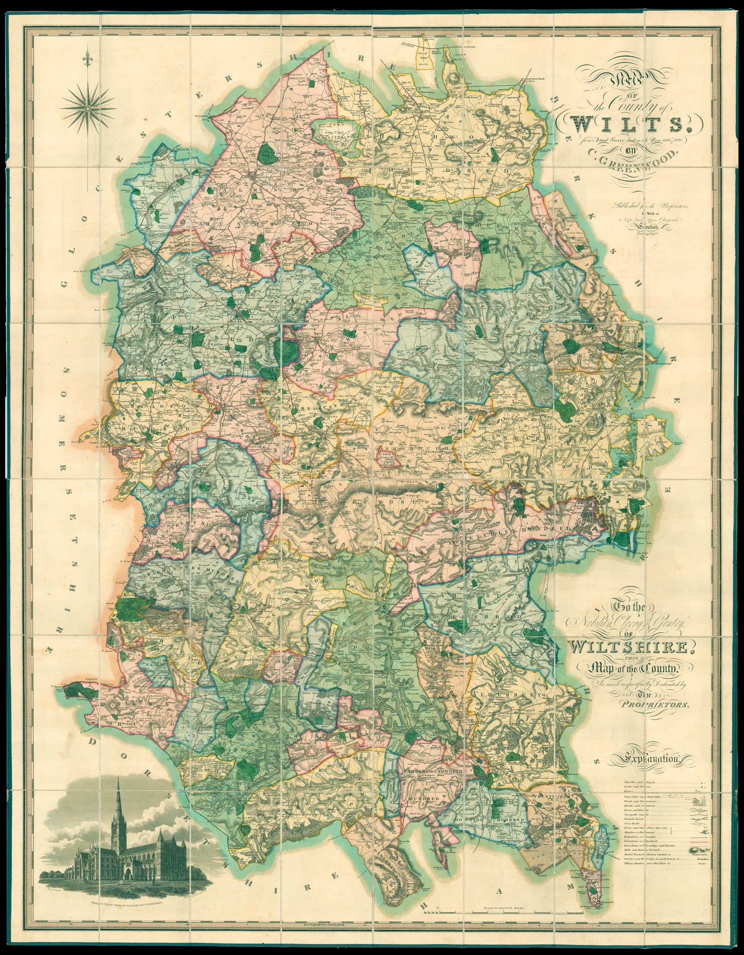
Map of the County of Wilts, from an Actual Survey made in the Years 1819 & 1820.
- 作者: GREENWOOD, Christopher
- 出版地: London
- 出版商: Christopher & John Greenwood
- 发布日期: Dec. 12th 1820.
- 物理描述: Engraved map in fine original full-wash colour, dissected and mounted on linen, in tanned calf pull-off slipcase, spine gilt, with green morocco label lettered in gilt.
- 方面: 1470 by 1150mm (57.75 by 45.25 inches).
- 库存参考: 11867
笔记
The maps by Christopher and John Greenwood set new standards for large-scale surveys. Although they were unsuccessful in their stated aim to map all the counties of England and Wales it is probably no coincidence that of the ones they missed, Buckinghamshire, Cambridgeshire, Herefordshire, Hertfordshire, Norfolk and Oxfordshire, all except Cambridgeshire were mapped by Andrew Bryant in a similar style and at the same period. From a technical point of view the Greenwoods’ productions exceeded the high standards set in the previous century though without the decoration and charming title-pieces that typified large scale maps of that period.
The Greenwoods started in 1817 with Lancashire and Yorkshire and by 1831 they had covered 34 counties. Their maps were masterpieces of surveying and engraving techniques, and in view of the speed at which they were completed, their accuracy is remarkable. They mark the boundaries of the counties, hundreds and parishes, churches and chapels, castles and quarries, farmhaouses and gentlemen’s seats, heaths and common land, woods, parliamentary representatives and distances between towns. To the lower left f the map is an engraved view of Salisbury Cathedral.
参考书目
- E.M. Roger, The Large Scale County Maps of the British Isles 1596-1850 (Oxford, 1970).
 地图
地图  地图集
地图集  珍本
珍本  版画
版画  天文仪器
天文仪器 


