 地图
地图  地图集
地图集  珍本
珍本  版画
版画  天文仪器
天文仪器 注册以了解我们最新的收购、展览和活动


地址
纽约
PO Box 329, Larchmont, NY, USA
开放时间,伦敦画廊
周一至周五:10:00-18:00
周六请预约
公休日:所有银行假日以及 8月1日至31日
营业时间,纽约
仅限预约

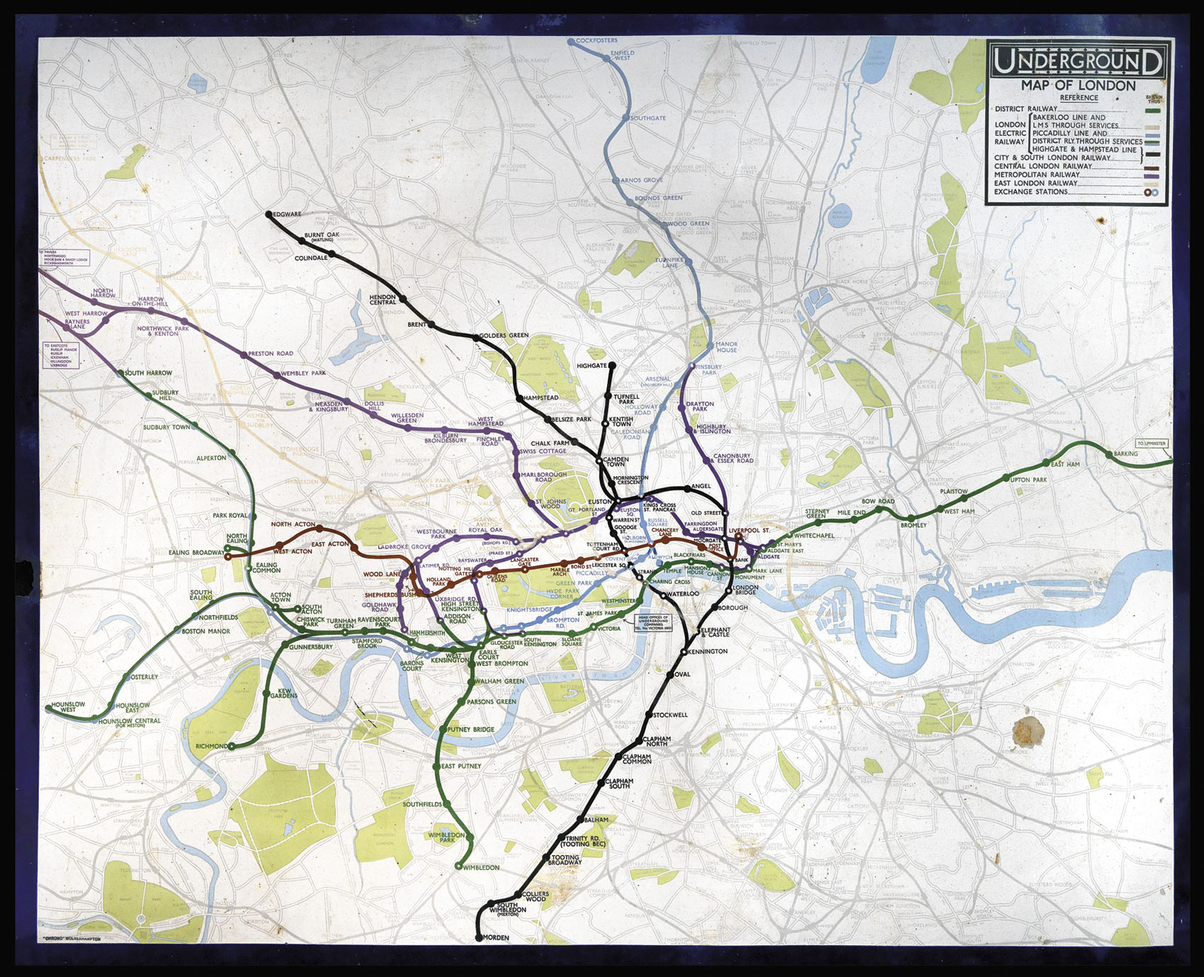
Geographical Map of 1930's London and her Underground Railway
Underground Map of London.
- 作者: GOSSOP, Reginald Percy
- 出版地: Wolverhampton
- 发布日期: Summer, 1933
- 物理描述: Chromolithograph map printed on metal, key and title upper right, small loss lower right.
- 方面: 1010 by 1270mm (39.75 by 50 inches).
- 库存参考: 2421
笔记
Large and detailed map of 1930’s London and her Underground Railway printed on metal.
The map superimposes the Underground network on a geographical map of London, and was drawn by Reginald Percy Gossop (1876-1951) who studied at the Hammersmith School of Art and produced maps and posters for the London Underground between 1916 and 1933.
The present map can be dated to around the summer of 1933, as it shows the Piccadilly line extending to Cockfosters, but does not mark Alesbury on the Metropolitan Line.
相关项目


/
请注册以了解最新珍品、展览和活动信息
地址
纽约
PO Box 329, Larchmont, NY, USA
开放时间,伦敦画廊
周一至周五:10:00-18:00
周六请预约
公休日:所有银行假日以及 8月1日至31日
营业时间,纽约
仅限预约