 地图
地图  地图集
地图集  珍本
珍本  版画
版画  天文仪器
天文仪器 注册以了解我们最新的收购、展览和活动


地址
纽约
PO Box 329, Larchmont, NY, USA
开放时间,伦敦画廊
周一至周五:10:00-18:00
周六请预约
公休日:所有银行假日以及 8月1日至31日
营业时间,纽约
仅限预约

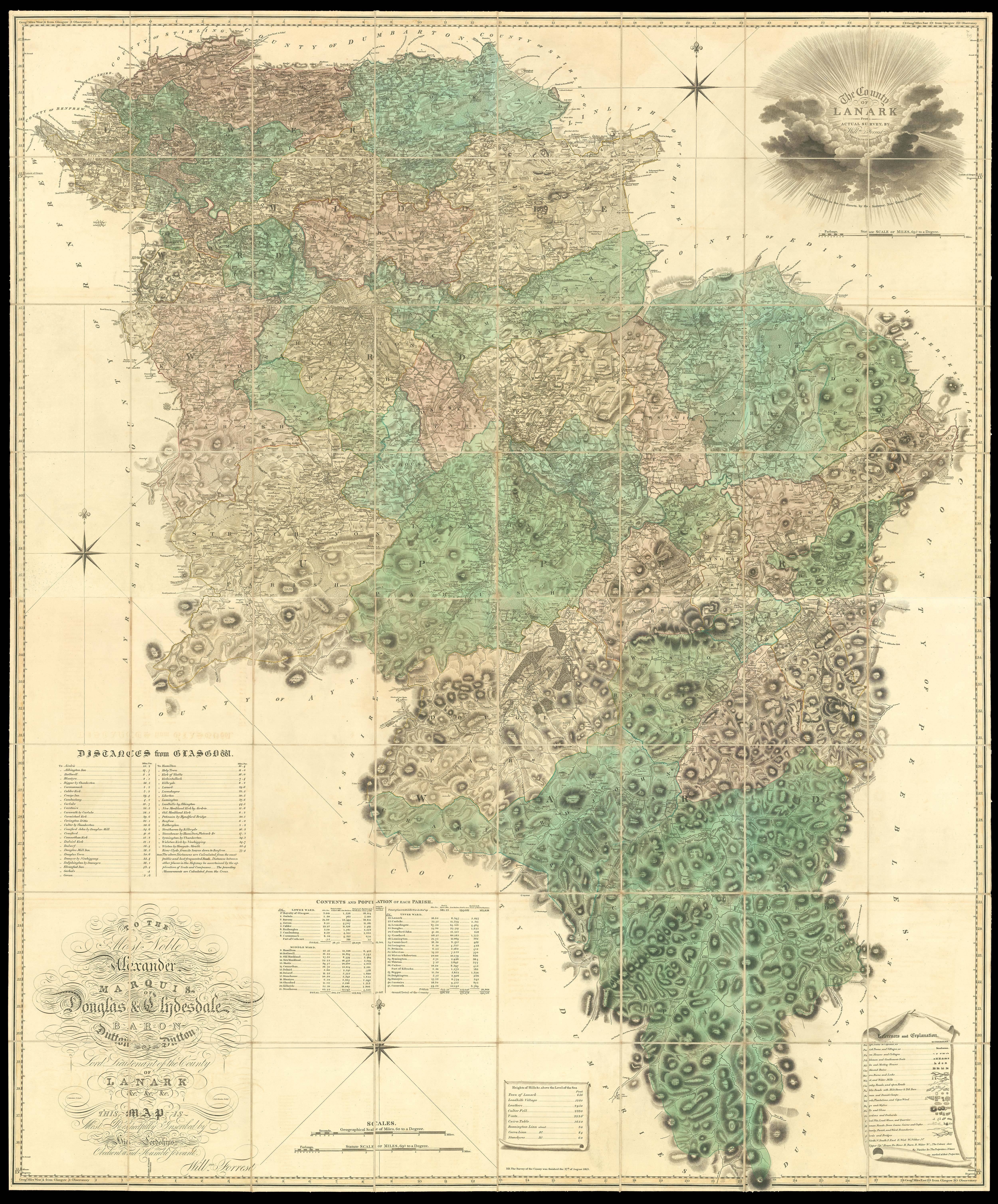
The County of Lanark from Actual Survey by Will[ia]m Forrest. To the Right Honourable John, Earl of Hopetown, Viscount Atherley, Lord Hope, … and Lord Lieutenant of the County of Linlithgow etc. This map is Most Respectfully Inscribed by His Lordship’s Most Obedient and Humble Servant, William Forrest.
- 作者: FORREST, Will[ia]m
- 出版地: Edinburgh
- 出版商: W. Forrest
- 发布日期: 1818.
- 物理描述: Large engraved map, fine original full-wash colour, dissected and mounted on linen, in two sections, housed in original green morocco slipcase, spine in compartments and lettered in gilt.
- 方面: 1780 by 1280mm (70 by 50.5 inches).
- 库存参考: 10787
规模化:

笔记
An outstanding example of a scarce Scottish large-scale survey.
A superb map of the area now know as West Lothian and embracing the old parishes of Torphichen, Bathgate, Whitburn, Bo’ness, Kirkliston, Linlithgow, Uphall, Abercon, Dalmeny and Cramond, etc. Much detail is shown including kirks, burns and lochs, Roman and Danish camps, and the Antonine Wall.
参考书目
- NLS EMS.s.33.
相关项目


请注册以了解最新珍品、展览和活动信息
地址
纽约
PO Box 329, Larchmont, NY, USA
开放时间,伦敦画廊
周一至周五:10:00-18:00
周六请预约
公休日:所有银行假日以及 8月1日至31日
营业时间,纽约
仅限预约