 地图
地图  地图集
地图集  珍本
珍本  版画
版画  天文仪器
天文仪器 注册以了解我们最新的收购、展览和活动


地址
纽约
PO Box 329, Larchmont, NY, USA
开放时间,伦敦画廊
周一至周五:10:00-18:00
周六请预约
公休日:所有银行假日以及 8月1日至31日
营业时间,纽约
仅限预约

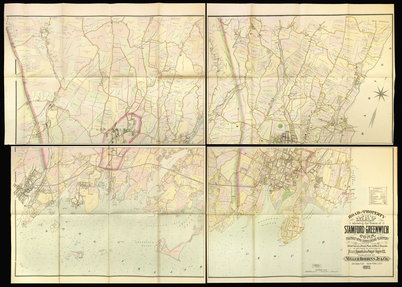

Road and Property Map showing the Towns of Stanford And Greenwich Conn. together with the surrounding territory compiled from actual surveys, private plans, and official records, by and under the direction of Miller Robbins Jr. & Forsey Breou C. E.
- 作者: ROBBINS, MILLER Jr. & BREOU.
- 出版地: New York
- 出版商: Published by Miller Robbins Jr. & Co., 36 Vesey St.
- 发布日期: 1890.
- 物理描述: Lithograph map, fine original hand-colour, dissected and mounted on linen, in four sections, a few minor tears to old folds, each section folding onto red calf board, rubbed.
- 方面: 1380 by 1800mm (54.25 by 70.75 inches).
- 库存参考: 3028
笔记
Very detailed huge wall map in four sections of Greenwich and Stamford, Connecticut, with surrounding towns. Names of the owners of various properties shown. Various tones of outline and shading color. Key for stores and dwellings, barns and stables, gas mains, water mains, sewer, steam railroad, horsecar railroad, public roads, private and proposed roads, churches, schools, cemeteries, factories and public buildings. Water depth indicated for Long Island Sound.
图片库
相关项目


请注册以了解最新珍品、展览和活动信息
地址
纽约
PO Box 329, Larchmont, NY, USA
开放时间,伦敦画廊
周一至周五:10:00-18:00
周六请预约
公休日:所有银行假日以及 8月1日至31日
营业时间,纽约
仅限预约