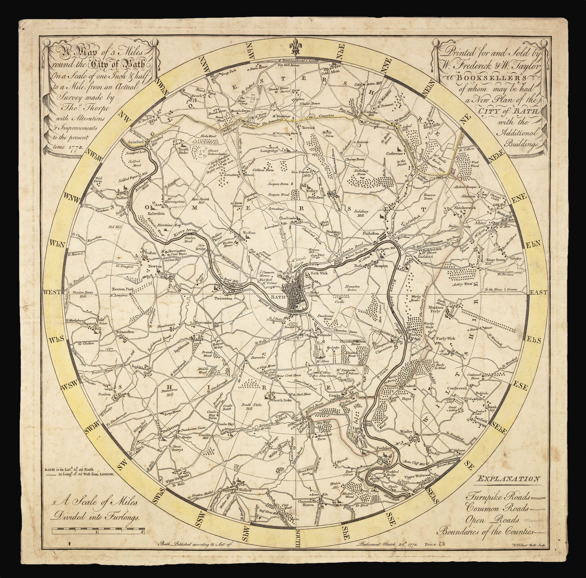

Rare Georgian map of the environs of Bath
[Somerset] A Map of 5 miles round the City of Bath On a scale of one Inch & half to a Mile, from an Actual Survey made by Tho: Thorpe with Alterations & Improvements to the present time 1773. Printed for and Sold by W. Frederick & W. Taylor Booksellers of whom may be had a New Plan of the City of Bath with the Additional Buildings.
- 作者: THORPE, Thomas
- 出版地: Bath,
- 出版商: Printed according to Act of Parliament,
- 发布日期: March 25th, 1773.
- 物理描述: Engraved plan with original hand-colour in outline.
- 方面: 440 by 440mm (17.25 by 17.25 inches).
- 库存参考: 14367
笔记
An unusual map of Bath, set in a round frame in imitation of a compass.
Bath was a fashionable destination for the nobility and gentry of Georgian and Regency Britain. The town itself contained the Pump Room, where the spa waters were drunk, the Theatre Royal, and the Assembly Rooms, where balls were held. The countryside around it was a popular destination for day trips and riding. Although nominally a spa town, it was also an important part of the marriage market, and was less formal than London. The year before this map was published, the playwright Richard Sheridan helped the soprano Elizabeth Linley escape from an arranged marriage and elope to France.
The map is a reduction of Thomas Thorpe's survey of Bath and its environs. Thorpe first published the large scale map on nine sheets in 1744. The reduction was first published in 1771, then again in 1773 (as in the present example), and in 1787, 1799, and 1800.
参考书目
- BL Cartographic Items Maps K.Top.37.10
- Needell, K., Printed maps & plans of the City of Bath 1588-1860, second edition, number 34 (page 61-62).
图片库
/
 地图
地图  地图集
地图集  珍本
珍本  版画
版画  天文仪器
天文仪器 


