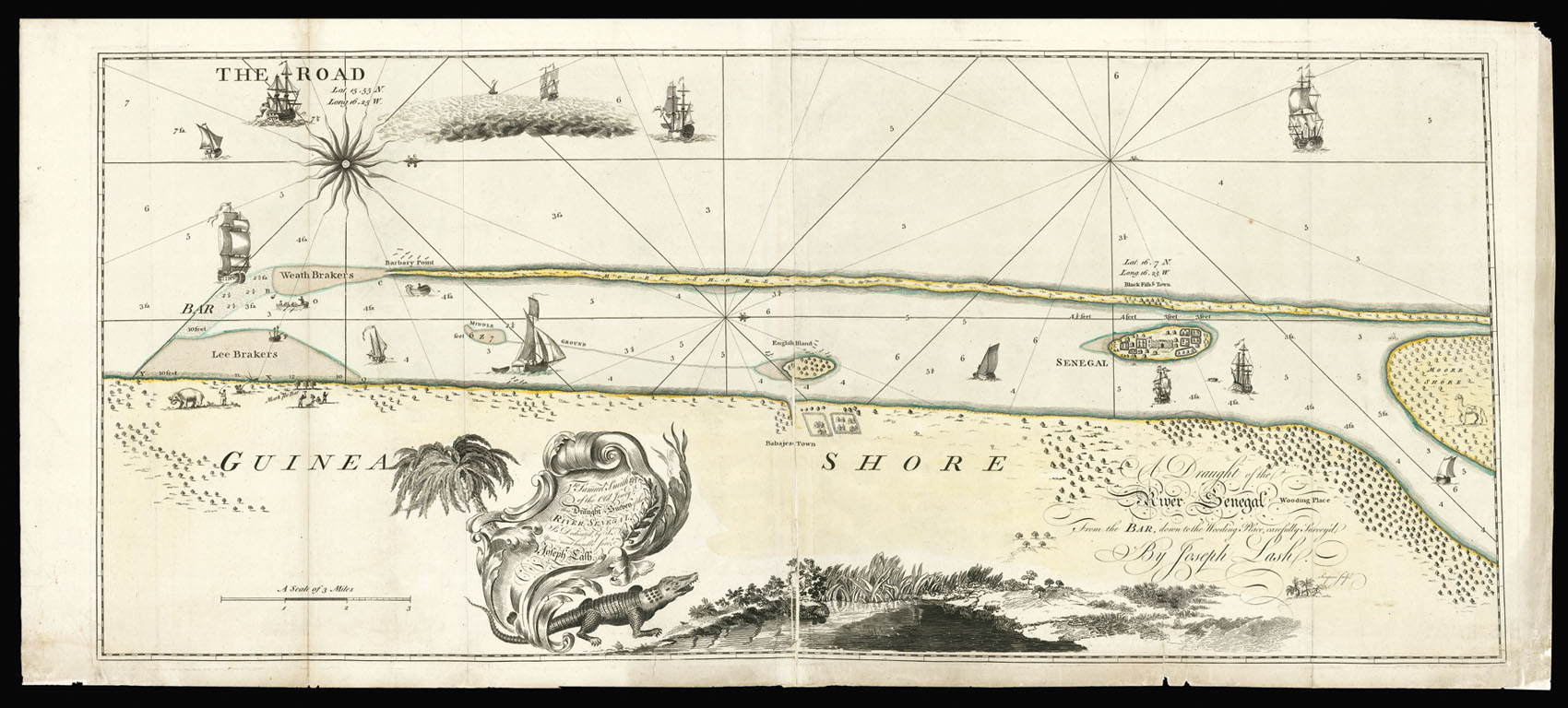

Rare chart of the mouth of the Senegal River
A Draught of the River Senegal, from the Bar down to the Wooding Place, Carefully Survey'd by Joseph Lash. To Samuel Smith Esq. of the Old Jewry, This Draught & Survey of the River Senegal. Is Dedicated by Your most humble Serv[an]t Joseph Lash.
- 作者: LASH, J[oseph]
- 出版地: [London,
- 发布日期: c.1765].
- 物理描述: Engraved chart on two sheets joined, fine original full-wash colour, a few old folds reinforced, minor loss to sheet join and margins skilfully repaired.
- 方面: 500 by 1100mm (19.75 by 43.25 inches).
- 库存参考: 2394
笔记
This rare chart depicts the mouth of the Senegal River. The chart orientated with west at the top and shows rhumb lines, soundings, and sand banks. To the right of the chart, on the island of Nadr, is the port of Saint Louis. The settlement was founded by the French in 1659, and controlled the lucrative trade in slaves, hides, beeswax, ambergris and gum arabic. Below the chart is an elaborate title and dedicatory cartouche, with depictions of a crocodile and the mouth of the Senegal river.
The map is dedicated to Samuel Smith, a lawyer and leading merchant of Old Jewry street in London, who had extensive interests in both America and the west African coast. Although the chart bears no date, one can date it between 1758, when the English gained control of Senegal from the French, and 1771, when Samuel Smith's business interest began to turn sour; he would be declared bankrupt in 1774. Little is known about the surveyor Joseph Lash - whose only published chart this would appear to be - apart from that he was most probably a navigator aboard one of Samuel Smith's ships that plied there trade between England, Africa and America.
We are only able to trace two institutional examples one in the National Library of Spain, and the other in the British Library, where it is bound into a composite atlas.
参考书目
- Shirley British Library, M.COM-5a.
图片库
/
 地图
地图  地图集
地图集  珍本
珍本  版画
版画  天文仪器
天文仪器 


