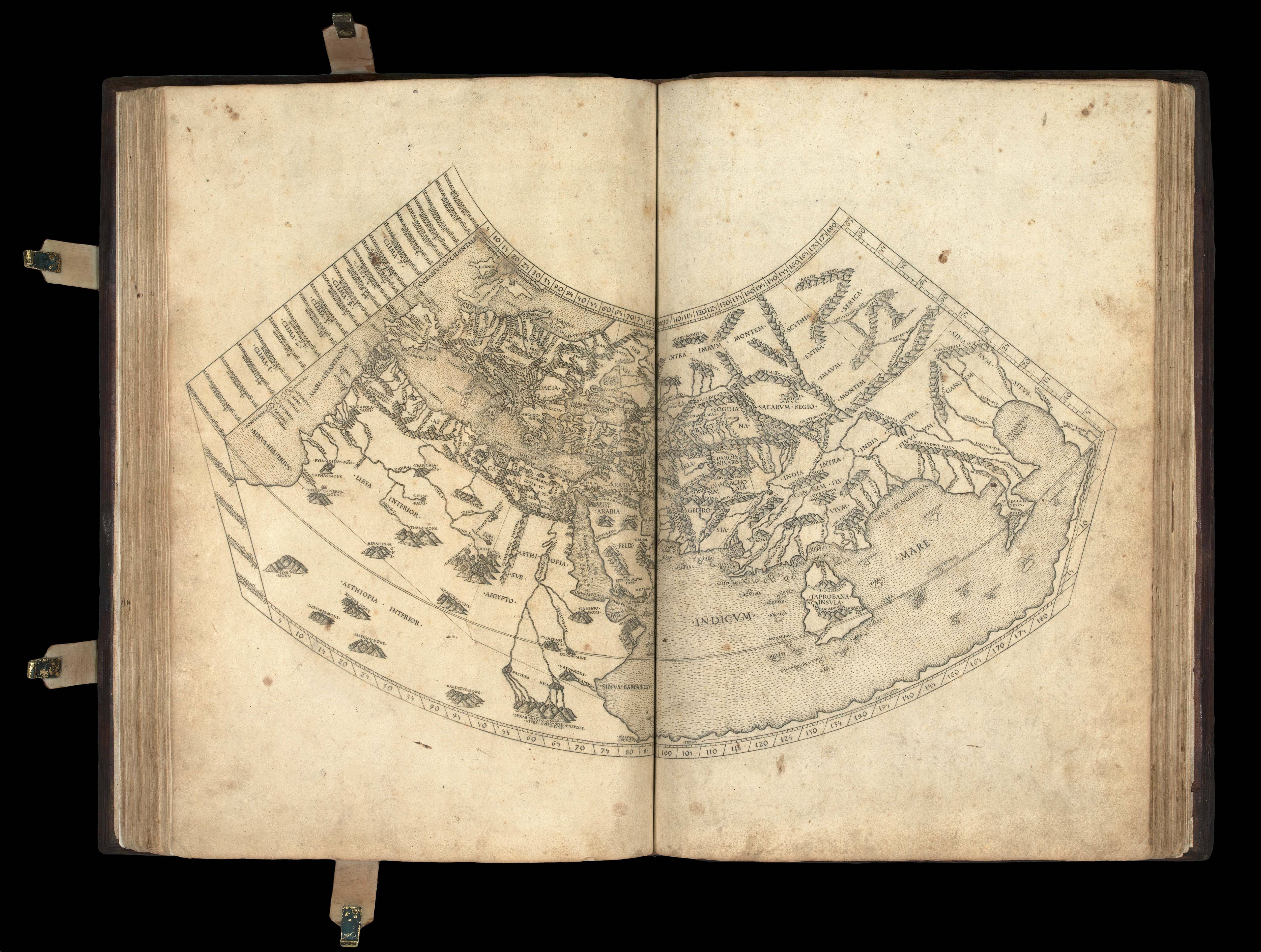


Ptolemy's first projection, with the "finest Ptolemaic plates produced until Gerard Mercator"
Cosmographia.
- 作者: PTOLEMAEUS, Claudius.
- 出版地: Rome,
- 出版商: Petri de Turre,
- 发布日期: 1490.
- 物理描述: Folio (425 by 282mm), loose endpaper/ initial blank on different paper, 27 double- page engraved maps, minor staining to world map, some loss to right edge of 'Quinta Asia Tabula' not affecting printed area, 'Sexta Asia Tabula' with small closed tear to title, small open tear to right edge and some brown staining, some minor brown staining to 'Decima Asia Tabula', minor wormholes to first two gatherings, occasional minor staining to margins not affecting text, very occasional manuscript annotations in faded ink, minor wormholes to final two gatherings; contemporary calf decorated in blind with intricate roll tool borders enclosing central diamond with woven rope motif, clasps with cross straps replaced, some areas of repair including triangular area c50-60mm to upper cover and small area to lower left hand corner of lower cover, early paper label with manuscript lettering in iron gall ink.
Collation: A8 (first leaf blank) B-C8, D6 (second leaf incorrectly signed D3), E6, a10 (first leaf blank), b-g8, h3 (lacking final blank leaf),
27 engraved maps, 2a8 (2a1r blank, 2a1v registrum super tractum de tribus orbis partibus, 2a2r-2c5r de locis ac mirabilibus mundi et primo de tribus orbis partibus), 2b8, 2c6 (lacking final blank leaf, 2c5r colophon: Hoc opus Ptholomei memorabile quidem
et insigne exactissima diligentia castigatum iucondo quodam caractere impressum
fuit et completum Rome anno a nativitate Domini.M.CCCC.LXXXX die.IV. Novembris. arte ac impensis Petri de Turre, 2c5v blank).
Watermark: text leaves watermarked with a cross within a circle, maps watermarked with a cardinals hat. - 库存参考: 12942
笔记
The "handsome" second Rome edition of Ptolemy's 'Geographia' (Scammell). The text of Claudius Ptolemy's (c100-170CE) "Cosmographia" was translated into Latin from the original Greek by Jacobus Angelus (c1360- 1411) and was first published, in Renaissance times, at Vicenza (1475), Bologna (1477) and Rome (1478).
The plates for the Rome editions of Ptolemy were several years in the making, and they are considered to be "the finest Ptolemaic plates produced until Gerard Mercator engraved his classical world atlas" a century later (Shirley). They were produced by two German printers, Conrad Sweynheym and Arnold Buckinck, and "it is believed that Sweynheym was the one who first thought of applying the very new art of copper-engraving to the printing of maps, and he might have taken a hand in the actual engraving of them himself " (Scammell). The first edition was printed in 1478, and the present edition was printed 12 years later from the same plates.
While the Bologna edition of 1477 was the first atlas and edition of Ptolemy to use copperplate maps, the Rome edition is generally regarded as superior for its clear captions, accurate projections and overall design. It includes more geographical details, including names in Arabia, in particular. Unusually, the seas are pock-marked. The early Italian Ptolemys, particularly the Rome editions, are "superb testimonials of Italian craftsmanship without the picturesque but unscientific monsters of the medieval maps or the addition of the adventitious decoration
of later work, relying for their beauty solely on the delicacy of their execution and the fineness of the material employed" (Tooley). As Tooley observes, the maps in the atlas have no external border decorations or co- ordinate lines, relying instead on the clarity of the engraving.
参考书目
- BL C.3.d.9
- Goff, P-1086
- Nordenskiöld, 7
- Sabin, 66474
- Shirley [World], 4
- Shirley [Atlases], T.PTOL-2c
- Scammell, 40
- Tooley, 'Landmarks of Mapmaking'.
图片库
视频导览
/
 地图
地图  地图集
地图集  珍本
珍本  版画
版画  天文仪器
天文仪器 


