 地图
地图  地图集
地图集  珍本
珍本  版画
版画  天文仪器
天文仪器 注册以了解我们最新的收购、展览和活动


地址
纽约
PO Box 329, Larchmont, NY, USA
开放时间,伦敦画廊
周一至周五:10:00-18:00
周六请预约
公休日:所有银行假日以及 8月1日至31日
营业时间,纽约
仅限预约

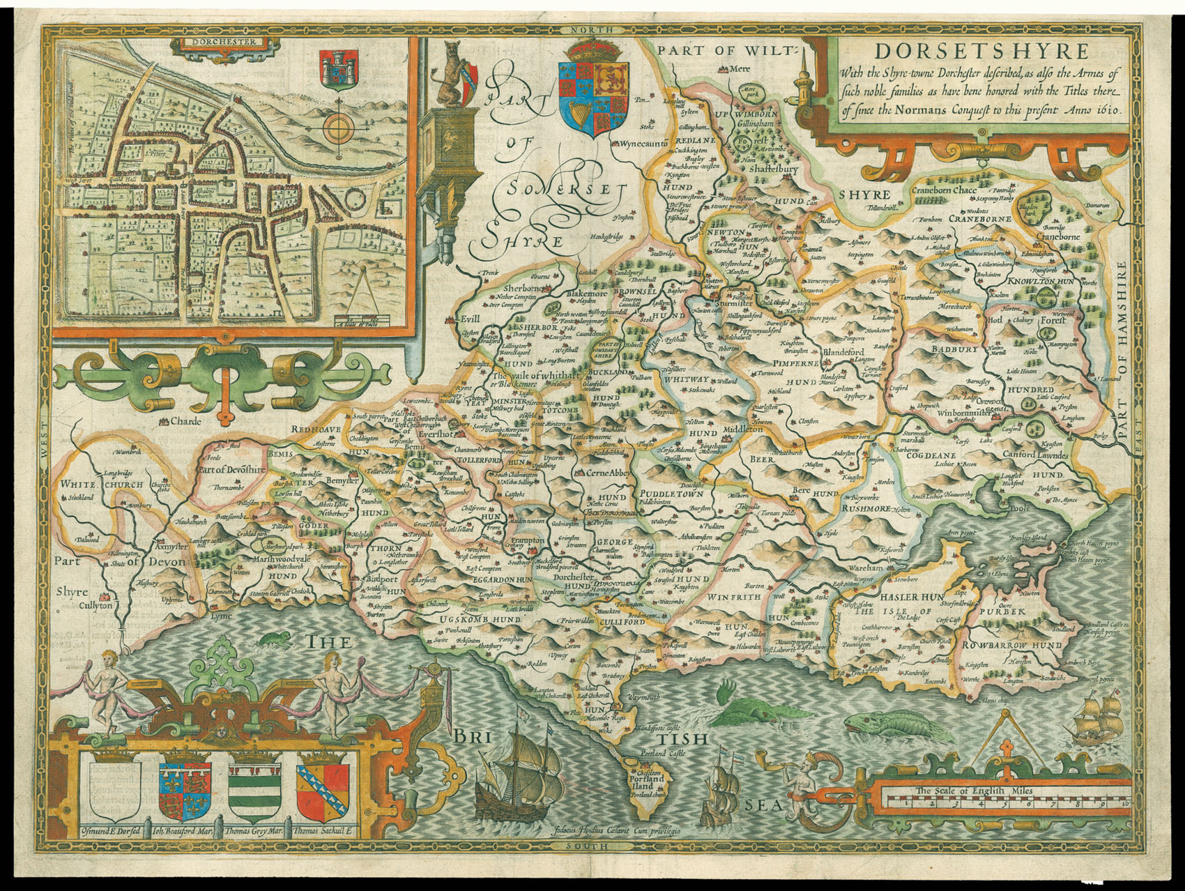
Speed's map of Dorset
Dorsetshyre With the Shyre-towne Dorchester described, as also the Armes of such noble families as have bene honored with the Titles there of since the Normans Conquest to this present Anno 1610.
- 作者: SPEED, John
- 出版地: London
- 发布日期: 1627
- 物理描述: Engraved map with hand colouring.
- 方面: 380 by 510mm. (15 by 20 inches).
- 库存参考: 11798
笔记
A map of Dorset, with an inset map of Dorchester.
John Speed (1552-1629) was the outstanding cartographer of his age. His ‘Theatre of Great Britain’ was the first atlas of the British Isles: Speed prepared the maps himself about two years before they were published. His maps and books dominated the seventeenth-century English market. The present map is taken from the 1627 English edition published by George Humble.
参考书目
- Chubb XXV.
相关项目


/
请注册以了解最新珍品、展览和活动信息
地址
纽约
PO Box 329, Larchmont, NY, USA
开放时间,伦敦画廊
周一至周五:10:00-18:00
周六请预约
公休日:所有银行假日以及 8月1日至31日
营业时间,纽约
仅限预约