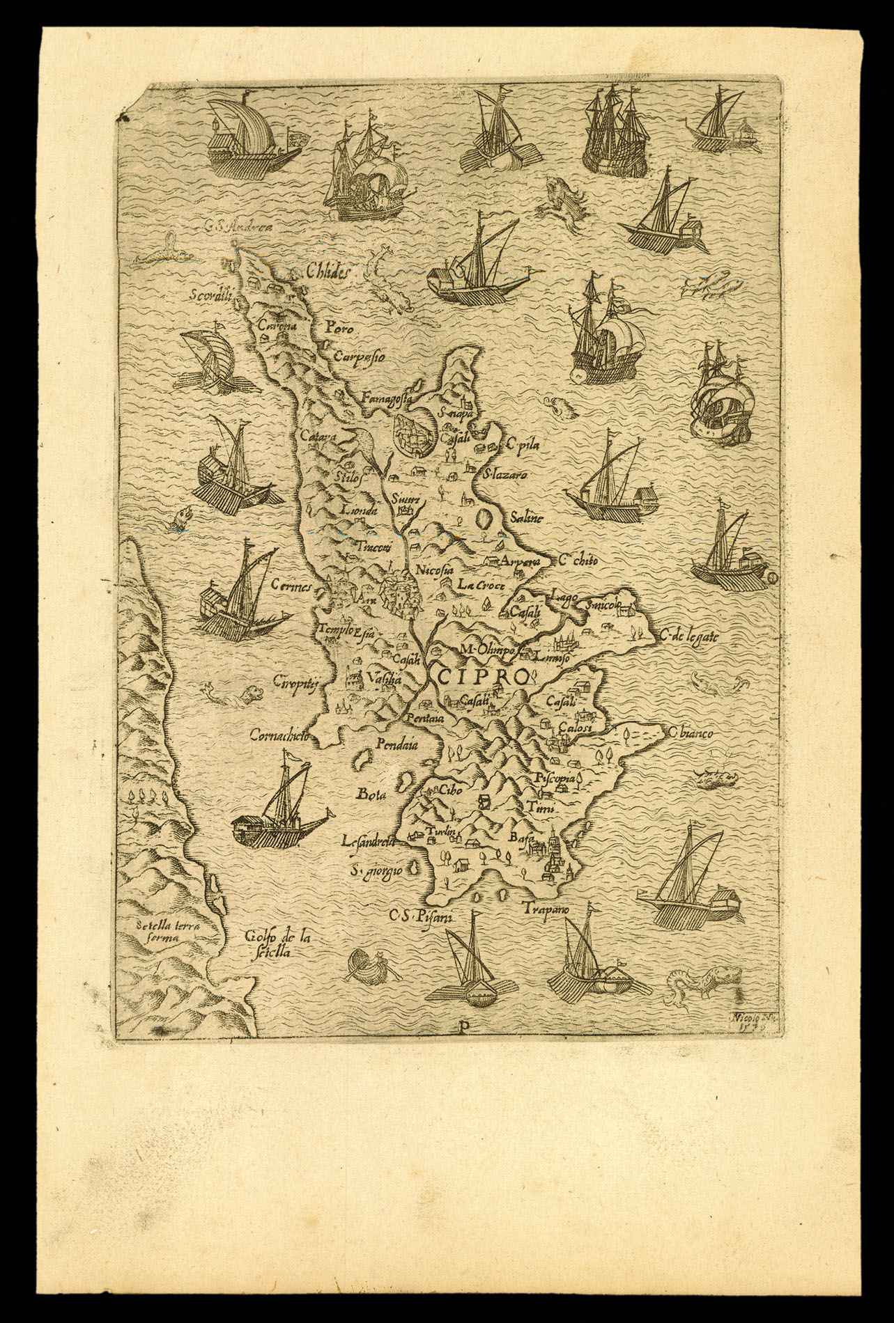

Second state of Nelli's map of Cyprus
[Cyprus]
- 作者: NELLI, Nicolò
- 出版地: Venice,
- 发布日期: 1571.
- 物理描述: Engraved map.
- 方面: 136 by 190mm. (5.25 by 7.5 inches).
- 库存参考: 12170
笔记
The second state of Nelli's map of Cyprus.
It shows the beginning of the Ottoman Empire's naval attacks on Cyprus. Cyprus had come under Venetian rule in 1489, but the Ottoman Empire made repeated attempts to reclaim the island. In the summer of 1570, Sultan Selim II ordered a full-scale invasion of the island. A Turkish fleet of 100,000 men commanded by Admiral Piale Pasha set sail and successfully took Nicosia on 9 September 1570. Famagusta fell the following year on 1 August 1571, and by the end of the year the Turks controlled Cyprus. The map shows the vessels of the Venetian fleet surrounding Cyprus. It is oriented towards the east, facing the direction of the Ottoman threat. It is a smaller version of a map by Claudio Duchetti, printed in Rome in 1570. Small maps like the present example were issued separately for loose sheet circulation and then often collected in a book to meet the interest of a specific customer. Nelli's map sometimes appears in the rare composite atlas by Simone Pinargenti, 'Isole che son da Venetia nella Dalmatia et per tutto l'arcipelago fino a Costantinopoli' (1573). Nicolò Nelli (1530-1573) was a Venetian engraver and printseller, who published the works of Giovanni Battista Fontana and Giorgio Ghisi and collaborated with Bertelli en Zaltieri.
It shows the beginning of the Ottoman Empire's naval attacks on Cyprus. Cyprus had come under Venetian rule in 1489, but the Ottoman Empire made repeated attempts to reclaim the island. In the summer of 1570, Sultan Selim II ordered a full-scale invasion of the island. A Turkish fleet of 100,000 men commanded by Admiral Piale Pasha set sail and successfully took Nicosia on 9 September 1570. Famagusta fell the following year on 1 August 1571, and by the end of the year the Turks controlled Cyprus. The map shows the vessels of the Venetian fleet surrounding Cyprus. It is oriented towards the east, facing the direction of the Ottoman threat. It is a smaller version of a map by Claudio Duchetti, printed in Rome in 1570. Small maps like the present example were issued separately for loose sheet circulation and then often collected in a book to meet the interest of a specific customer. Nelli's map sometimes appears in the rare composite atlas by Simone Pinargenti, 'Isole che son da Venetia nella Dalmatia et per tutto l'arcipelago fino a Costantinopoli' (1573). Nicolò Nelli (1530-1573) was a Venetian engraver and printseller, who published the works of Giovanni Battista Fontana and Giorgio Ghisi and collaborated with Bertelli en Zaltieri.
参考书目
图片库
/
 地图
地图  地图集
地图集  珍本
珍本  版画
版画  天文仪器
天文仪器 


