- Home
-
浏览
-
探索珍品
-
关于我们
地址
纽约
PO Box 329, Larchmont, NY, USA
开放时间,伦敦画廊
周一至周五:10:00-18:00
周六请预约
公休日:所有银行假日以及 8月1日至31日
营业时间,纽约
仅限预约


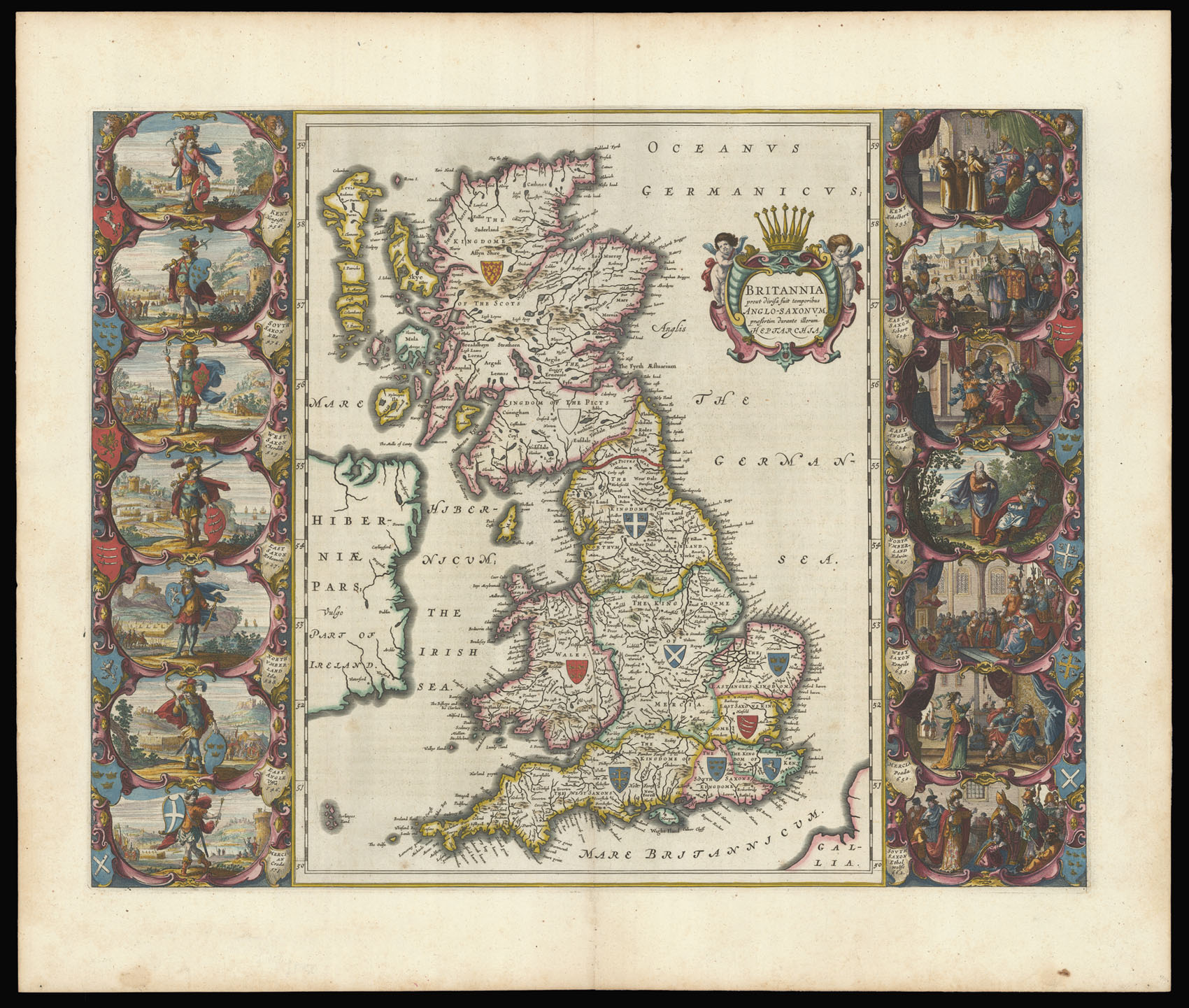
One of the most decorative maps of the British Isles ever produced
Britannia prout divisa fuit temporibus Anglo-Saxonum praefertin durante illorum Heptarchia.
British Isles
Great Britain
- 作者: BLAEU, Joan
- 出版地: Amsterdam,
- 发布日期: 1645.
- 物理描述: Engraved map in fine original hand colour.
- 库存参考: 12256
笔记
Blaeu's famous "Heptarchy" map showing England, Scotland, and Wales divided into the seven Anglo-Saxon Kingdoms.
This stunning map is a superb example of Dutch cartographic design and is one of the most decorative maps of the British Isles ever produced. The dramatic vignettes to each side of the map depict the founders of each of the seven Kingdoms, whilst the scenes on the right show the conversion of the various Kingdoms to Christianity. Closely modelled on Speed's 'Heptarchy' of 1611, the vignettes surrounding Blaeu's version have been completely redone in the grand style of Dutch contemporary paintings.
This stunning map is a superb example of Dutch cartographic design and is one of the most decorative maps of the British Isles ever produced. The dramatic vignettes to each side of the map depict the founders of each of the seven Kingdoms, whilst the scenes on the right show the conversion of the various Kingdoms to Christianity. Closely modelled on Speed's 'Heptarchy' of 1611, the vignettes surrounding Blaeu's version have been completely redone in the grand style of Dutch contemporary paintings.
参考书目
图片库
相关项目
/
地址
纽约
PO Box 329, Larchmont, NY, USA
 地图
地图  地图集
地图集  珍本
珍本  版画
版画  天文仪器
天文仪器 


